Unless you’re a budding physicist, marine biologist, or are experienced with equipment used in our oceans, the idea of multibeam sonar mapping may be perplexing. But the truth is, although it may sound technical and difficult to understand, it’s actually not.
Put simply, sonar beams use sound waves to detect what’s underneath the surface of the sea. Their pulses bounce off the seafloor and back to examine what’s below. Sonar beams are multifaceted, and are used for a range of purposes, by a range of organizations carrying out investigations or environmental projects throughout our oceans.
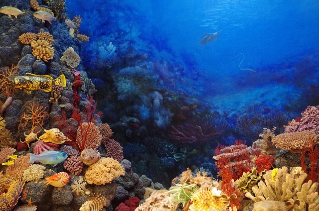
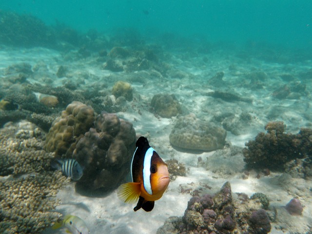
Sonar is used instead of cameras because of the issues imposed by cloudy water and poor lighting. Sonar relies on sound waves, which can move effectively through water. Imaging sonars come in three types: mechanical, multibeam and sidescan.
This post will focus on the latter two, so keep reading to find out more about multibeam sonar mapping and how it can be used to aid conservation projects and marine explorations.
What is Multibeam Sonar?
Multibeam sonar uses multiple sonar beams to simultaneously detect large underwater areas. It is predominantly used for multibeam sonar mapping. This is simply the process by which the seafloor is mapped out, water depths are confirmed, and any characteristics of the seabed are identified.
There are also single-beam sonar systems that are capable of mapping out the seabed directly below the vessel, but multibeam sonar systems are more powerful and can assess a larger area. Because more sonar beams are used, the results are more extensive and accurate.
Multibeam sonar is usually carried out by multibeam echo sounders, which are devices with highly sensitive sensors and transducer arrays. It is usually attached to the hull of the vessel, and the multibeam systems send out what are known as “acoustic waves” in a fan-like shape to cover as wide an area as possible.
Multibeam sonar identifies two things: the depth of the seabed and backscatter. Backscatter can help to identify the shape of the seafloor, any obstacles like plants, animals or objects that may be residing on the seabed and any other characteristics of the seafloor.
The depth of the water, also known as the bathymetry, is measured by calculating the amount of time the beam takes to leave the sonar, reach the seafloor and bounce back.
If you’re examining shallow areas, mapping sonars can be used from the vessel’s hull. However, if the area you’re assessing is deeper, you may find that towing the device from ships or attaching them to other remotely operated vehicles may give you a clearer picture.
However, many multibeam sonar devices must be mounted onto ships, so this should factor in if you’re hoping to tow the scanner. Other devices may be more appropriate.
Different frequencies are used for different water depths, as high frequencies (anything above 100kHz) are used to calculate shallow waters, and low frequencies (anything below 30kHz) are used to assess deeper waters.
Backscatter, however, is identified by calculating the amount of sound that comes back to the sonar. Different types of backscatter receive sound energy differently, indicating whether the surface is hard or soft and bumpy or flat.
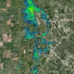
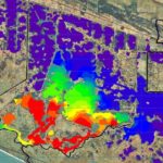
The combination of bathymetry and backscatter data allows scientists to create meticulously detailed maps of our seafloors. Bathymetric maps are often colorful and will help to visualize the seafloor in more depth. Red and orange colors signify shallow areas, whereas greens and yellows indicate deeper areas.
via Pixabay
What Are the Applications of Multibeam Sonar?
Multibeam sonar is most commonly used for multibeam sonar mapping. Multibeam sonar mapping is often the first step in identifying new areas. With basic information such as sea depth, characteristics of the sea floor, etc., scientists can then conduct more comprehensive investigations.
Multibeam sonar technology has drastically changed the way seafloors are mapped. Unlike previous single-beam systems, multibeam sonar makes seafloor mapping quicker, more detailed and more accurate.
By collecting data more efficiently, maps are higher-resolution and give a more accurate idea about where potential problems may lie. By pinpointing these areas, scientists can quickly plan further investigations and take precautions.
What is Multibeam Mapping?
Multibeam mapping is the product of multibeam sonar activity. It involves mapping out the vessel’s surrounding seafloor to identify the depth, type and characteristics of the seabed.
Sonar beams are released from multibeam echosounders, pointed at the seafloor. When the beams hit the floor, they bounce back to the vessel, where staff will monitor their return and the results produced.
This cycle is called a ‘ping’. Each ping can span depths between 100 and over 7,000 meters. Computers will then collect the data from each sonar beam, how deep the sonar beam reached, and where the beam struck.
The longer a beam takes to return to the vessel, the deeper the waters. However, the type of material the beam hits at the bottom, tidal currents, and the way in which the vessel is moving can impact these results.
With approximately only 5% of global seafloors mapped by multibeam sonar systems, there seems to be considerable gaps in our knowledge of the ocean. In order to conduct conservation projects, deep sea mining, and marine explorations, bathymetric maps and hydrographic surveys are vital.
The information provided by a bathymetric map can tell us huge amounts about the health of ecosystems under the sea, the types of land underwater and can inform scientists of any potential hazards.
Not only will the identification of hazards help submarines and ships navigate these areas safely in the future, but the information gained about the health of underwater areas can aid environmental projects.
On top of the color-coding system, you’ll notice that bathymetric maps are also bumpy. This shows any bubble plumes that may be in the area. Bubble plumes are pockets of trapped methane that are slowly being released into our oceans.
This can considerably contribute to climate change and will negatively impact the health of aquatic ecosystems. So, identifying where bubble plumes are located is essential for environmental conservation and protection.
If we know the state of coral reefs and marine ecosystems, we can enforce measures to protect and save them.
Multibeam sonar systems are not the only effective method of detecting underwater land, LiDAR is known to work well underwater and can also produce high-quality underwater maps. It has a similar scanning technique, and by varying the sensors on the device, LiDAR systems can be used in both deep and shallow waters.
Side scan sonar systems can also be used. These are very similar to multibeam sonar systems and can provide similar results
via Pixabay
What is the Difference Between Side Scan Sonar and Multibeam Sonar?
The difference between side scan sonar systems and multibeam sonar systems is simply that while the multibeam looks forward, the side scan looks to the side.
A side scan sonar system produces an image of the seabed below, both to the left and right of where it is positioned.
Side scans and multibeam systems can be used in search investigations, using solar technology to detect inaccuracies in the water and on the seabed.
Both are useful devices for underwater scanning and detection. The multibeam imaging sonars have a little more flexibility, as they can be pointed in any direction. Whereas the side scan sonars give detailed coverage of what’s left and right of them.
Interestingly, using the correct software, a multibeam can perform a similar function to the side scan, producing a similar image, however, they will not be as detailed to the left and right and will take longer to complete a structured search.
The multibeam has instant results, meaning you can remain stationary and quickly scan the area reasonably fast. While the side scan only allows scanning on the sides, it covers a greater area quicker than the multibeam.
However, the multibeam is arguably more versatile, capable of scanning forwards and having the flexibility to be pointed elsewhere. It can perform a greater number of tasks, but depending on what you need it for, the side scan may be a more efficient choice, providing high-quality images at a faster rate.
The multibeam echo sounder is a great device if you’re covering large, deep areas. However, the angle of coverage is narrow in shallow waters.
Seafloor mapping should be carried out using multibeam sonar, as its ability to map out all characteristics, regular and irregular, of the seabed and any accompanying vegetation is far greater.
On the whole, multibeam sonar systems should be used for seafloor mapping, and side scan sonar is better suited for detecting obstacles.
This is why side scan sonar technology is often the more appropriate choice in search projects, whereas for general seafloor mapping, detecting irregularities on the seabed and assessing the depth of waters, multibeam sonar technology is the better choice.
Depending on the project, teams may use a mixture of multibeam sonar and side scan sonar to achieve the best results. A combination of the two can produce high-quality images and maps that provide maximum detail.
Final Thoughts
Multibeam sonar is highly useful for teams who aim to map out seafloors. Its high-resolution results can determine places of concern, determine the depth of waters, and even detect bubble plumes.
For these reasons, multibeam sonar mapping is incredibly useful for marine exploration projects, future navigation, and environmental conservation.
Multibeam sonar systems will be used by organizations globally in order to find out more about our seas, their depths and their potential dangers.
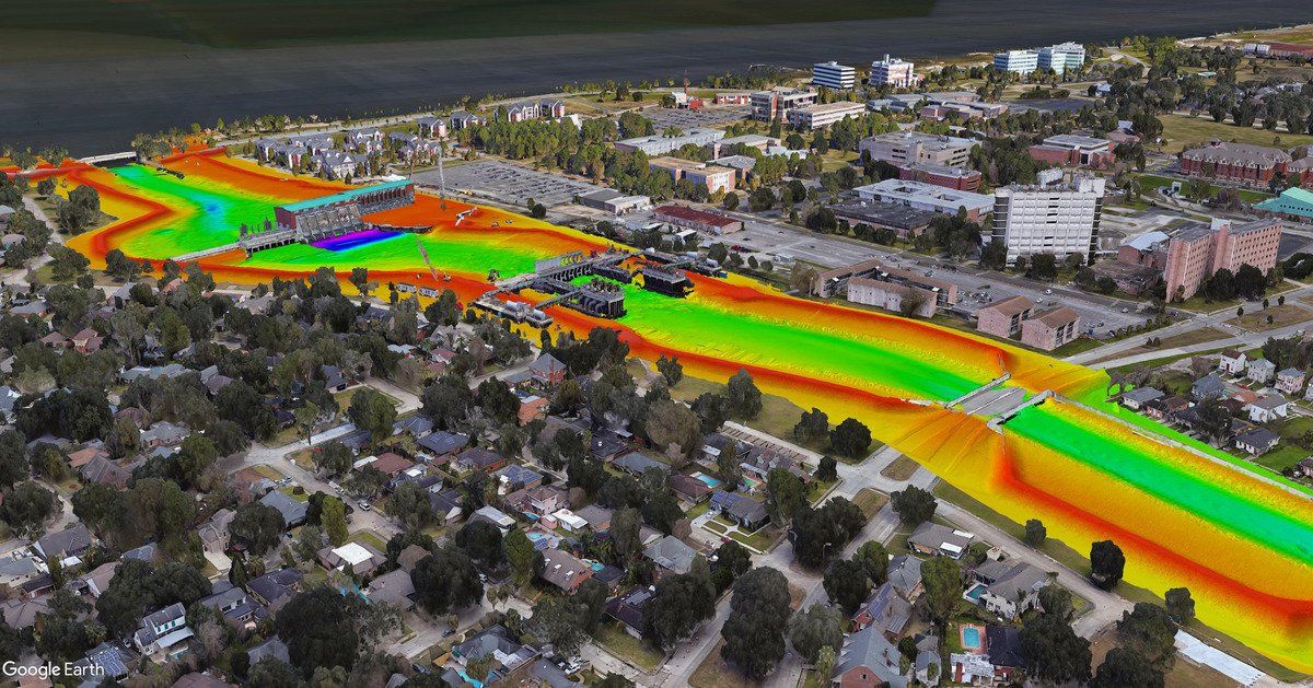
The Fenstermaker survey and mapping team has more information on how sonar technologies, including multibeam sonar systems, are being used in real projects across America.