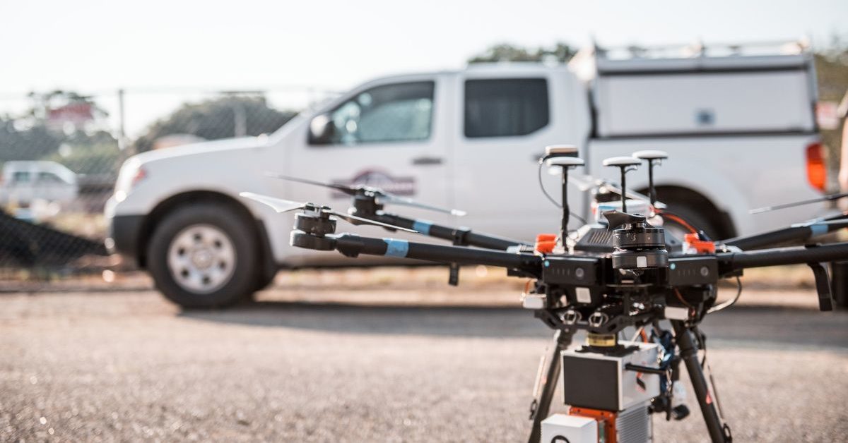
Mobile mapping is the process of collecting geospatial data by using mobile vehicles like cars, drones, boats, trains, or airplanes. These vehicles are typically equipped with a range of GNSS, photographic, laser, radar, LiDAR or other remote sensing systems.
Mobile mapping systems allow for the continuous calculation of 3D position, velocity, and altitude. This technology has many applications in corporate infrastructure management, military and defense, roadway and highway mapping, urban planning, environmental monitoring, and other industries, too.

via Unsplash
Traditional methods of mapping involving primary triangulation from aerial points are no longer efficient or effective in the modern world. Mobile mapping is the broad term for a technological frontier that has reduced costs and logistical difficulties associated with traditional mapping techniques, democratizing mapping processes and making them more accessible.
What is a Mobile Mapping Survey?
A mobile mapping survey is the data collection process that is used to determine the positions of points on the surface of the Earth and calculate the angles and distances between them. This data is used to make maps and aid in numerous mapping applications.
While “mobile mapping” is a more general term for the technological advances that have changed the mapping industry, a mobile mapping survey refers to the actual process of collecting mobile mapping data that can later be used for civil engineering, environmental preservation, or any number of other purposes.
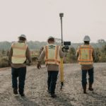
For instance, a vehicle equipped with 3D laser scanning and imaging technology might drive at normal traffic speeds through an urban center. That vehicle is undertaking a survey of the area through which it’s driving, and individuals can then download the data off the hardware attached to the vehicle.
A successful mobile mapping survey will yield direct georeferencing, accurate point clouds, live feedback in the field, and noise-free precise results.

via Unsplash
What Software is Used for Mobile Mapping?
The software used for mobile mapping is produced by various companies and has the aims of managing, extracting, and sharing 3D data. Various AutoDesk applications, Gexcel Reconstructor, and Bentley MicroStation are among the most popular software options.
Some mobile mapping systems also come with their own software. The top mobile mapping systems include the Leica Pegasus, the Trimble MX50, the Lynx H2600, the Reigl VMY-2, and the Mosaic Viking.
For example, the Leica Pegasus is a product that’s made for conducting mobile mapping surveys, and it has a suite of panoramic cameras and high-performance laser scanners. Its software bonuses include cloud-based data storing and sharing as well as multiple sync ports for extracting images taken during the survey.
Other products, like the Trimble MX50, have a more fully developed software suite that includes a complete “field-to-finish” workflow that begins with capturing data in the survey stage and also allows users to process, extract, and share that data. The LynxHS600 offers another attractive quality in its real-time data processing, so users can begin processing data while the survey is still happening.
Likewise, the Mosaic Viking offers a high-res 360-degree camera system that captures extremely realistic 3D models with a variety of uses, including asset and facility mapping, real estate, media and entertainment, vegetation/ROW management, and mapping for civil engineering (building bridges, tunnels, and streets).
Generally speaking, mobile mapping software offers tools that allows its users to make maps, analyze data, collect and update data, and share and collaborate on projects. Software is part of the essential toolbox needed for mobile mapping and can semi-automate feature extraction and analysis, reducing costs and labor further.
What are the Applications of Mobile Mapping?
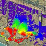
The applications of mobile mapping are not industry-specific, and they include mapping roadways, railways, streams, coastal geographic features, piers, buildings, and other above-ground and underwater utilities. A mobile mapping project is more likely to succeed the more access the mobile mapping vehicle can get to its surroundings.
Mobile mapping began taking off in the 1980s as a response to the federal government’s need to map its highway infrastructure. But since then, mobile mapping has spread into many other industries, and its applications are nearly innumerable.
These systems have gained a foothold in city planning, disaster management, railway mapping, indoor mapping, construction, and environmental preservation (particularly coastal management). The mobile mapping market is expected to reach a market value of $63.32 billion by 2026, so there’s clearly huge growth potential and burgeoning interest.
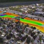
The most common working environments in which mobile mapping is used are topographic and site surveys, residential and office buildings, construction sites, industrial buildings, and roads, rails, and bridges.
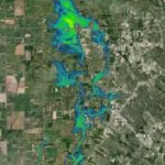
Many of its specific applications, including land use mapping and flood mapping, are crucial across industries. Land use mapping involves mapping with the purpose of identifying an area of land’s use and classifying different types of land. It’s highly relevant to topics like land conservation and planning.
Flood mapping involves creating maps that show where water will flow during a flood and pinpointing land areas that could be affected by flooding.
Mobile mapping allows previously inaccessible areas to be mapped quickly and effectively by using advanced imagery and measurement capture tools. It also improves safety and delivers significant benefits to both asset owners and technology users.
How Accurate is Mobile Mapping?
Mobile mapping is fairly accurate, with an intermediate accuracy that falls between airborne and terrestrial LiDAR. The accuracy of the data depends in part on the mobile mapping system being used. Generally, data is up to 20mm absolute accuracy and 5mm relative accuracy without ground control points.
By adding in surveyed ground control points to a survey, absolute accuracy can be improved to below 10mm. Making sure that you’re using a reputable source for mobile mapping or investing in strong technology is crucial to getting the most accurate mobile mapping possible.
An engineering and environmental consulting firm like Fenstermaker that specializes in surveying and mapping may be a great place to turn.
What are the Limitations of Mobile Mapping?
The limitations of mobile mapping include budgetary concerns, misconceptions about accuracy, return on investment, and the quality of deliverables. All of these limitations are considerations that the mobile mapping industry is currently working to address.
In a survey of professionals in industries where mobile mapping is common, those respondents who did not use or plan to use mobile mapping considered budgetary restrictions the biggest roadblock. As mobile mapping technology continues to improve and grows more widespread, costs should fall making these tools more accessible.
Previously, it was thought that mobile mapping was a neat innovation, but not one that was high-quality enough for professional work. Although that preconception has been debunked by current industry innovations, many people still have that bias, and this prevents mobile mapping from being as widely adopted now as it might be in a few years.
Mobile mapping is a growing and evolving industry, and it’s a hotbed of innovation. As such, many of the limitations of mobile mapping will be combated in the coming years as technology continues to develop. As the quality of deliverables improves and the technology becomes more widespread, prices will drop, making it easier for users to recoup their initial investment.
It’s also worth noting that mobile mapping is currently best suited for certain types of surveying. It’s best for column-shaped mapping that involves long, narrow spaces. It’s not as effective yet for mapping wide-open spaces. But as mobile mapping technology changes and continues to evolve, that restriction may change as well.
Final Thoughts

via Unsplash
Mobile mapping essentially involves geospatial data collection through vehicles including vans, drones, boats, cars, trains, and planes. Said vehicles are fitted with mapping and surveying equipment and remote sensing systems.
After a mobile mapping survey is completed and data is collected, mobile mapping software allows users to extract and analyze data, which can then be used for a number of different purposes. Mobile mapping systems are successful when they provide data including direct georeferencing, real-time feedback, clear images, and accurate point clouds.
Mobile mapping offers a compelling suite of solutions to businesses across various sectors. It’s used in logistics, financing, military and defense, construction, surveying and mapping, urban planning, disaster management, railroad mapping, aquatic mapping, and construction. And it’s popular among both government contractors and private companies.
Whatever your interest in mobile mapping technologies, a consulting firm that specializes in mobile mapping can be an excellent place to start when you’re assessing your needs. Surveying and mapping can be a crucial piece of successful project execution, and mobile mapping has changed the industry, making it easier than ever to perform your mapping tasks.