Land surveying is used to create topographical maps and measurements of land that are used in industries like land development and construction. In the past, it’s been an expensive and time-consuming process that involves high-tech equipment and complex calculations. Using drones to survey land is quickly becoming a more popular and efficient alternative.
In this article, we’ll look at different uses for drones in surveying as well as some of the benefits they bring.
 via Pixabay
What is a Drone Survey?
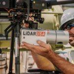
Drone surveys are measurements of land that are done by drones that are equipped with sophisticated technology like LiDAR sensors and multispectral cameras. The drone flies close to the ground taking high-resolution pictures from different angles, which are then tagged with coordinates.
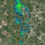
LiDAR sensors work by sending light pulses to the ground and then measuring how long it takes to come back, which gives us exact measurements of land or distances between objects. The LiDAR measurements, pictures, and coordinates collected by drones are used to create detailed 2D and 3D maps, which are in turn used for land use documentation and planning.
What are Drones Used for in Surveying?
Drones are being used more and more in all sorts of surveying projects. Some of their most common uses include cartography, land management, land development, and urban planning. Let’s take a more detailed look at each of these.
Cartography
Drones are used a lot to create cadastral maps, which are used for determining land ownership and taxes. Before drones, it was extremely hard to get detailed cadastral maps of areas that were hard to access. To create accurate maps, we need to know about the land’s elevation, water sources, and geological makeup—which can all be learned by using drones.
Land Management
Land management is important in a variety of industries, including agriculture, forestry, energy, real estate, and government. Drones are ideal for land management surveys. They can fly much closer to the ground than satellites or airplanes so they’re able to get more detailed images and measurements. This provides land managers with accurate data to make better decisions.
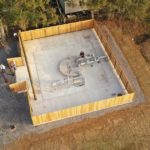
Land Development
Land development involves changing a landscape for any number of reasons. It’s used to convert land for agricultural use or to designate pieces of land for building homes and other buildings. Traditional methods of surveying for land development can be expensive and surveyors have to walk the undeveloped land, which can be dangerous on certain terrain.
Drones can survey large areas of land in just a few minutes and don’t need to use any expensive extra equipment. When drones are used, surveyors don’t need to go anywhere near dangerous terrain, which means they stay safer.
Drones can also be used to monitor progress once development starts. Because drones are fast and cost-effective, it’s easier to have them fly over the same areas over and over to get the most updated information. This means everyone involved can identify problems early on before they become expensive and hard to correct.
When drones are used to monitor progress during a project, there’s no need to pause operations. Drones can gather all the information we need without getting in the way. This translates to better monitoring, increased safety, and saving time and money.
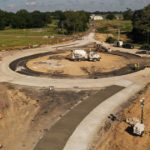
Urban Planning
Urban planning is the process of developing land and infrastructure for city use. It has to be meticulously planned to make sure it’s efficient and safe for the public. Some of the information needed is hard to get, especially in areas where there are a lot of people.
Drones map land areas as well as buildings, roads, and bridges. Drones can cover long distances quickly and can even fly to the top of tall buildings and bridges in minutes. They collect data accurately and efficiently while they’re flying over land and around structures.
The data collected by drones is processed with software that produces 3D models of the land and any architecture present. Drones also help with traffic analysis, corridor mapping, and environmental assessments for urban planning.
What are the Benefits of Drone Surveying and Mapping?
Surveying using traditional methods can be expensive and time-consuming. Here’s a quick look at surveying performed by traditional methods versus surveying done by drone. [Text Wrapping Break]
| Traditional Techniques | Drone Surveying |
| Requires multiple types of equipment | Only requires the drone and its software |
| Takes days or weeks to be completed | Can usually be done in an hour or two |
| Expensive | Cost-effective |
| Limited quality of data collection | Highly accurate and detailed data is collected |
| Limited by terrain | Can access hard-to-reach places safely |
 via Pixabay
Uses a Single Tool
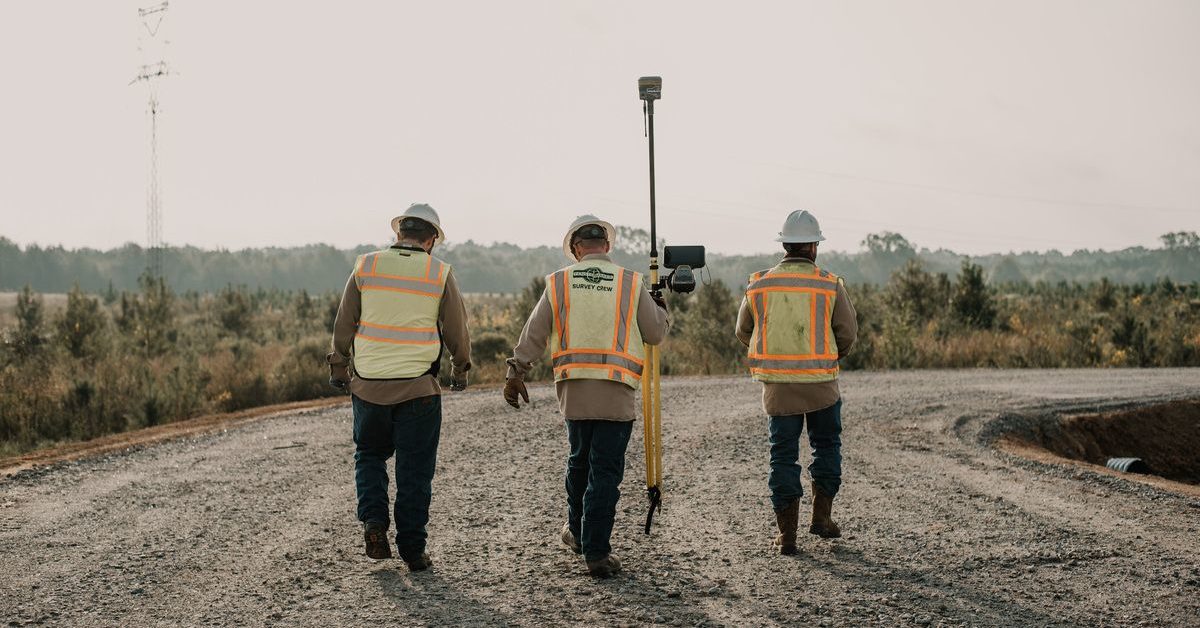
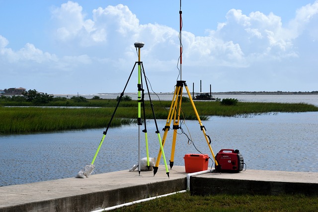
Traditionally, surveying land requires lots of equipment, including levels, tripods, chains, tapes, measuring wheels, magnetic locators, and more. Not only that, but the surveyors themselves need safety gear like reflective vests and hard hats. When tall structures are on the land being surveyed you’ll need ladders and scaffolding too.
The cost of the equipment can add up quickly. All of it has to be transported to every site and then set up and moved around as needed, which is extremely time-consuming. When you’re done using the equipment, it has to be cleaned and stored somewhere safe so it doesn’t get damaged.
Drone surveys only need the drone itself. Some surveys use Ground Control Points (GCPs) and you’ll need end-to-end mapping software on a phone or computer for data processing, but the only equipment you’ll have to transport to the site is the drone.
Reduces Duration
Surveying can take a long time. Depending on the size of the land to be surveyed, it can take days or even weeks to complete. Traditional surveyors usually have to walk the area on foot and haul a bunch of equipment with them. By the time the survey is done, some of the data might not even be accurate anymore.
Sometimes surveys are completed using airplanes or helicopters, which means you’ll have to coordinate with local airports, hire a pilot, and get fuel, and the data is only collected as fast as the aircraft can move.
Drones can launch immediately, without the hassle of checklists and fueling beforehand. They’re able to cover large areas quickly and they’re not slowed down by challenging terrain. The same can’t be said about surveyors.
One drone survey usually takes about an hour or two, depending on the exact amount of land that needs to be surveyed. This means that the data collected is always up to date and surveys can be repeated as often as needed.
Reduces Costs
Performing land surveys by drone is a lot cheaper than performing them in person. Traditional surveys need teams of surveyors who will have to be paid for days or weeks of work to complete one job. With a drone survey, the only labor cost is for the remote pilot who’s only needed for about an hour or two of work.
Provides Accurate and Extensive Data
Traditional surveys can’t always get all the data we need. They do provide land measurements and surveyors can take pictures using a camera from areas they can get to, but it’s not as effective or detailed as it would be if a drone was used instead.
Drones use high-tech devices to get detailed data. Multispectral cameras aimed at the ground capture detailed aerial images, including near-infrared light, which isn’t even visible to the naked eye.
LiDAR sensors use light pulses to measure elevations and distances and turn them into highly detailed 3D land maps. LiDAR can go through groundcover or work in the dark to collect data even in areas that can’t be seen by a camera or the naked eye.
3D land maps are an important tool for land management and development, cartography, and urban planning. They recreate topographical information that can be analyzed from anywhere to make sure all plans are efficient.
Map Difficult or Impossible-to-Reach Areas
Drones can easily move around in areas that are hard to reach otherwise. Mountains, large lakes or rivers, and other tough terrains can limit the extent of traditional surveys.
Drones also work in dimly lit places and can easily maneuver through trees. They can fly over busy roads, fast-moving bodies of water, and dangerous terrains while the remote pilot remains out of harm’s way.
With drones, there’s no need to close down highways or stop construction work when a survey needs to be done. Drones can still get accurate information without posing any danger to surveyors.
Final Thoughts
Drones can get land surveys done quickly and more accurately than traditional methods. They’re also less expensive and safer for everyone. The survey and mapping team at Fenstermaker can help you plan your next land surveying project. Got questions? Contact us today to learn more about drone surveying.