Drones improve the operation of construction sites by providing real-time data. They increase accuracy while improving safety and cutting costs. In this article, we’ll discuss some of the ways that drones are being used in construction and the benefits that they bring.
How Are Drones Used for Construction Inspections?
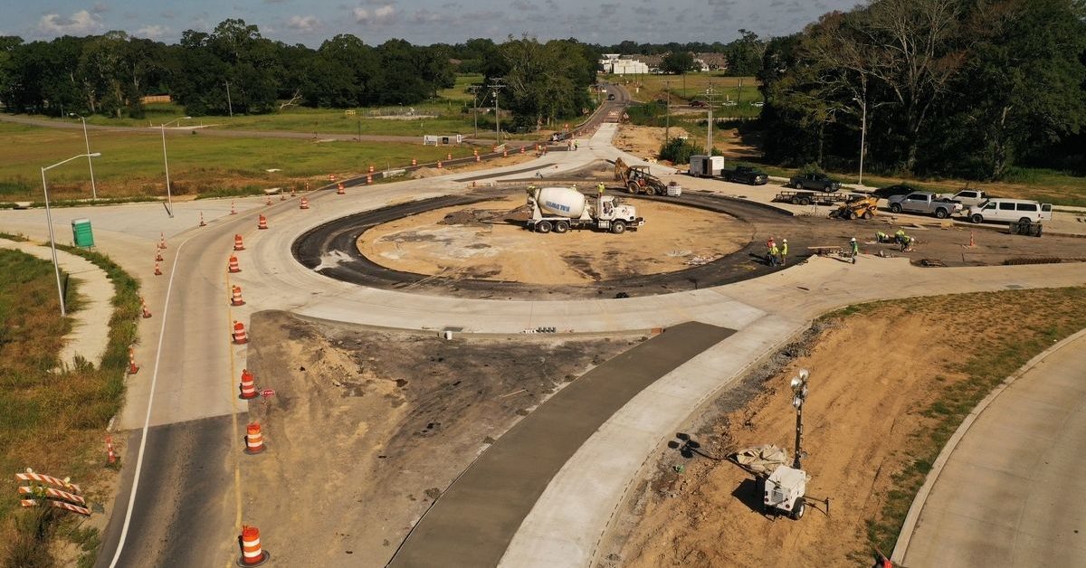
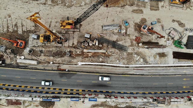
Drones are being used for a variety of purposes during construction inspections. From initial site evaluations to project monitoring, they’re used the whole way through lots of different types of projects. They’re also able to provide site security.
Next, we’ll take a look at some of the most common uses for drones in the construction industry.
Site Measurements
Accurate site measurements are critical when planning construction projects. They’re used to create better bids and more accurate estimates. Precise measurements allow for better planning when purchasing supplies so there’s less wasted material—and money.
Having more accurate measurements helps project managers create a secure site perimeter, ensure that equipment is set up and correctly placed, and plan for any potential hazards.
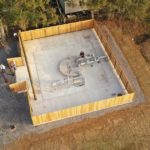
Construction sites can be pretty big and it’s extremely time-consuming to get precise measurements by hand. Drones can scan an entire site in minutes, collecting accurate measurements that are useful for construction teams as they put together their initial proposals and plans of action.
Traditional aircraft that need a pilot—like helicopters and planes—are sometimes used to scan sites and collect measurements, but it’s expensive and complex. Planes and helicopters are expensive anyway, plus you’ve got to pay the pilots. You’ll have to abide by the local airport’s rules and there’s usually a lot of time-consuming paperwork involved.
Drones can be deployed much faster, with setup and launch taking just a few minutes. They’re much less expensive to operate than large aircraft and they can maneuver more precisely thanks to sophisticated mapping programs.
Project Progress Monitoring
During construction, inspections project managers used to have to walk the entire construction site for progress updates. This is not only time-consuming, but it also makes it harder to get real-time feedback about the project.
When managers have to walk the site over and over to keep up to date on everything that’s happening, it takes away from the time they have to coordinate plans and communicate with the team and the client.
Drones provide real-time aerial footage of progress, which helps managers make on-the-fly decisions. Using drones also helps to catch mistakes early, before correcting them becomes expensive and time-consuming. Drones equipped with thermal imagers can detect inconsistencies in concrete and find water leaks so they can be fixed immediately.
Certain parts of construction projects have to be approved by the foreman or project manager before work can continue. When the project manager has to walk around and visually inspect everything in person, it can cause delays that slow down progress.
Drones can provide detailed images quickly so the manager or foreman can give the “OK” quickly and employees can keep working without much interruption. This helps to keep projects on schedule.
Drone images can help track supplies so that managers always know what they have on hand and can predict a material shortage before it becomes a problem that delays construction.
Another benefit of using drones to collect information is that the data can be seen by clients and other stakeholders from anywhere, increasing client satisfaction and helping with day-to-day operations and decision-making.
Data collected by drones creates a detailed, permanent record, while walk-through inspections are usually written with a brief summary—if at all. The permanency of these records is useful if something goes wrong. It allows teams to identify where problems started, or even to prove where problems were avoided, and can also be used to improve planning for future projects.
Surveillance and Security
Drone surveillance is in-depth and cost-effective. It improves safety for workers and the public and helps keep construction sites secure. Using drones for surveillance allows potential safety hazards to be pointed out and dealt with quickly.
Drones can identify things like unsafe equipment that could jeopardize workers’ safety. Early detection of hazardous conditions and malfunctioning equipment prevents accidents and injuries, possibly even saving lives.
Surveillance by drones can also improve the safety of the public by finding weaknesses in the site’s perimeter, like a broken piece of fence. Construction can be dangerous, especially for people who aren’t supposed to be there. By identifying areas where members of the public could wander onto the site, managers can quickly fix these weaknesses and prevent accidents.
Making sure the site stays secure is also better for construction workers and the project overall. If people know that it’s easy to get into a specific work site, it could encourage vandalism and theft. Break-ins can be expensive and can delay work. They can also lead to accidents that could seriously injure workers.
Construction Site Mapping
One of the best advantages of using drones to inspect construction sites is that they create detailed 3D images of the site that can be used in planning or updating the needs of the project.
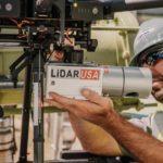
Drones that are equipped with LiDAR sensors emit light pulses that measure distances between objects to construct highly accurate 3D land maps. Land maps show things like elevation and type of terrain, which helps construction managers as they plan construction activity. Land maps also help to keep track of changes in conditions because of weather and construction activity.
LiDAR maps can also be used to check buildings and other structures to help teams monitor construction. These maps can help to check for discrepancies against the original plans and share progress with clients.
Drones are the ideal vehicles for LiDAR systems because they can get detailed pictures from any angle and fly close enough to structures to get the most accurate information. And because they’re cheaper to use, they can be used to collect data continually, providing the most up-to-date information possible for managers to work with.
Access of Difficult to Reach Areas
Drones can get into hard-to-reach areas so workers can inspect the images from a safer spot. A lot of construction site structures are tall and hard for inspectors to reach, and manual inspections need ladders, scaffolding, and other potentially dangerous equipment.
Inspecting these hard-to-reach places by drone improves worker safety and cuts down on the time that’s needed to inspect them. A remote pilot can stay safely on the ground and fly the drone anywhere it needs to go. Drones can even be pre-programmed with flight routes for repeated data collection.
Drones are also able to look at things that are dangerous to inspect otherwise. They can even inspect equipment while it’s in operation, which minimizes downtime and delays so projects can be completed on time.
Volume Surveys
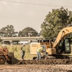
Volume surveys are used during construction projects to keep track of dirt that’s moved around in huge amounts. They’re also known as earthwork surveys and are crucial for keeping projects organized and on schedule. Accurate volume surveys minimize the need for bringing in or getting rid of excess dirt.
Traditional methods of performing land surveys, like the grid method or cross-section method, involve complex calculations and a lot of manpower. They’re very time-consuming and labor-intensive but aren’t always that accurate.
Some projects don’t have the resources to complete surveys during the process, so they have to be done at the beginning and end of construction. This means managers lack a lot of data and have to make their best guess.
Drones can finish volume surveys quickly, usually in about 20 minutes. This makes it more feasible to do them consistently, giving managers real-time updates and keeping everyone on the team aware of the project’s status. Frequent surveys help to identify small issues quickly before they become serious and expensive problems.
Using drones with advanced mapping software gives much more accurate measurements than any traditional method can provide.
What Are the Benefits of Drone Inspections for Construction?
There are lots of benefits to using drones for construction site inspections. They’re fast, accurate, cost-effective, and they’re safer for both workers and the public. In this next section, we’ll look at more of these benefits in detail.
Speed
Drones carry out inspections of construction sites in a fraction of the time it takes for inspectors to do visual walk-throughs. Drones can scan large sites quickly and can fly to the top of tall buildings and structures in minutes. The need to move and set up scaffolding, ladders, and other inspection equipment is pretty much eliminated.
During manual inspections, equipment has to be shut down and work has to stop so inspectors can safely see what they need to see. Using drones for inspections minimizes downtime because drones can inspect heavy equipment and machinery while it’s in use.
Projects are finished faster since drones collect data frequently and catch errors or problems early. This means corrections can be made right away, minimizing the need to backtrack to find where things went wrong. Making on-the-spot corrections streamlines the process and reduces the chances of needing to make expensive repairs later on.
Improved Accuracy
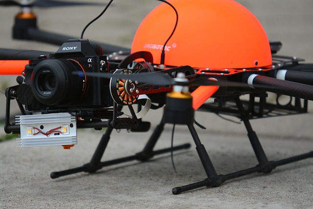
Using drones makes construction site inspections more accurate. Drones capture extremely detailed images using technology like high-resolution cameras, LiDAR, GPS, radar, and thermography.
Drones can see structures from angles that are impossible to see in person and can fly the same routes over and over to get the most up-to-date information. Detailed site maps and surveys give managers and inspectors better views of the work being done much easier and faster than conducting inspections by hand.
Data collected by drones is stored remotely so that inspectors, project managers, crew members, and other stakeholders can study it at any time from anywhere.
Decreased Costs
Drones cut costs on construction projects in a variety of ways. They help to keep projects on schedule, which reduces labor costs, and they help keep track of inventory, which allows for more accurate supply ordering and minimizes waste. Drones also minimize the need for expensive equipment or personnel such as scaffolding, aircraft, and pilots.
Improved Safety
Drones improve safety for construction workers, inspectors, and the public. Inspectors and other workers don’t have to worry as much about falling because drones provide birds-eye views and minimize the need for crew members to climb. Workers also don’t have as many equipment-related accidents because drones help ensure equipment is safe to use.
Public safety is improved because routine drone checks alert the construction team right away if there’s a break in the perimeter fence that would allow people to wander onto the site—intentionally or not—and put themselves in harm’s way.
When drones are used for inspections, projects can be completed faster and more accurately, which could also mean that there are fewer accidents in structures after they’re completed.
Final Thoughts
Drones are becoming a staple on construction sites because of their benefits. Fenstermaker’s UAV mapping services can help you take advantage of these benefits during your next construction project. Contact us today to learn how using drones can save you time and money while making your projects better and your clients happier.