When you think of farming, idyllic pastures and slow-rolling tractors might come to mind. But modern agriculture has come a long way and technology is being used a lot more in farming. Today’s farms might even have drones flying overhead from time to time, a sight that might surprise you.
via Pixabay
Drones help farmers plan, manage, and monitor their crops and livestock. In a world where the climate is changing quickly and the population keeps getting larger, it’s becoming even more important to manage our resources. In this article, we’ll explore some of the ways drones are being used in agriculture today.
Crop Planting
Drones are used to plan crop planting and even to actually sow seeds. Drones equipped with high-resolution cameras and LiDAR sensors collect data that are used to create 3D land maps. These maps give farmers a detailed overview of their entire property, including information about elevations and terrain types. This helps them plan their crops so they get the best yields.
Thermal imagers analyze soil to see where it’s best to plant, which helps when planning the most effective crop-planting strategy possible. This real-time feedback helps farmers make informed decisions about planting that will get healthier crops and better yields.
Once the land has been analyzed and the farmer knows the best locations for the crops to be planted, drones are able to physically sow seeds into the soil. You can put a seed-filled container on the drone that shoots the seeds into the ground as the drone hovers over it.
If you need to plant in a larger area, using drones can save you tons of time, money, and manpower. You can also plant in remote areas without disturbing existing crops and save yourself from walking over tough terrain.
You can use specialized drones that are able to sow without wasting a bunch of seeds. This can save money, improve planning, and protect resources.
Crop Yield
Drones are also used to assess crop yields. This is usually done by using multispectral imaging, which can help you see light on wavelengths you can’t normally see, like infrared light. Both near-infrared sensors and RBG (red-blue-green) cameras are useful for plant counting as well as looking for space issues between plants.
Drones used for assessing crop yield should be equipped with GPS navigation, a multispectral camera, and stabilized gimbals to make sure you get the best high-resolution images and videos you can.
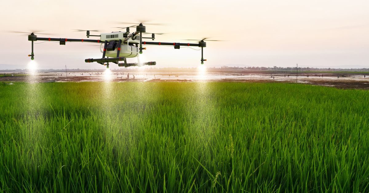
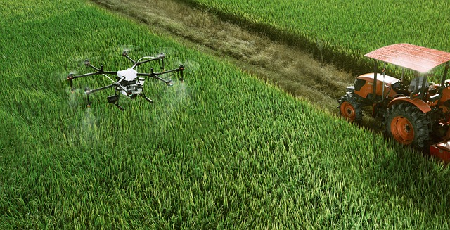
Crop Spraying
Spraying crops with fertilizers and pesticides has always been a very labor-intensive process, especially for large pieces of land. It generally means either using large manned aircraft or lots of workers wearing backpacks full of chemicals walking through the fields.
Spraying crops with an airplane, also known as crop dusting, can be dangerous. Because they need to fly lower to the ground, pilots have to navigate around power lines, homes, and trees. It’s also hard to avoid stalling the engine at such a low altitude. In North America alone, there are five crop duster accidents a month, on average.
Pesticides have to be applied carefully, which is harder when using full-size aircraft. Too much pesticide use can lead to health problems in the community as well as higher costs for growers. Aircraft exhaust can also reduce air quality in the surrounding areas. And, of course, hiring experienced agricultural pilots can be pretty expensive.
Spraying manually is time- and labor-intensive, which can translate into higher costs. It can also expose workers to high levels of pesticides, some of which have been linked to increased incidences of certain cancers, organ damage, and reproductive problems like infertility and stillbirth.
Using drones to spray crops reduces the time and manpower you’ll need to use, as well as cutting costs, and reducing exposure to dangerous pesticides. Drones can fly quickly over large areas, reducing the time it takes to treat crops. The only manpower required is the drone pilot, which means lower costs for you.
Obstacle avoidance systems keep drones from hitting powerlines, trees, or other structures. And if an accident did somehow happen, there wouldn’t be any injuries because the pilot wouldn’t be in the plane.
Drones that have spraying systems are designed to reduce waste so crops can be sprayed precisely. This means chemical runoff into local waterways is minimal and the health of farm workers and other members of the community is kept safe.
Using too much fertilizer or pesticide wastes money and resources and can decrease the quality of your crops. If you don’t use enough fertilizer, your plants won’t grow as well, and if you don’t use enough pesticide, your plants are more vulnerable to pests. Drones made for spraying can distribute chemicals evenly to make sure nothing is wasted.
Crop Damage Assessment
Crops can get damaged from any number of things. Some of the more common causes of crop damage are extreme weather, flooding, drought, improper application of chemicals, wildlife, and pests. It’s important that you’re able to identify damaged crops quickly to prevent low yields or even total crop failure.
Assessing crops has always required workers to walk the fields and visually inspect them. This is time-consuming and hard to complete as often as it takes to catch problems early. Visual inspections are also less accurate because sometimes damage can’t be seen by the naked eye until it’s too far gone.
Drones are completely changing how crop damage assessment is done. They can be flown over croplands regularly because they’re less expensive to operate. After extreme weather events, they can be sent out right away, even if conditions are too dangerous for a walk-through inspection.
Multi-spectral cameras can “see” damage to crops before it’s visible to us. Because they can view light on wavelengths that aren’t usually visible, they’re able to detect stress in crops very early on. Damaged crops tend to reflect more red light and less near-infrared light.
Detection of Plant Diseases
Drones can also be effective at identifying diseased plants long before they become symptomatic thanks to thermal imaging. Thermal imaging captures tiny temperature differences in objects. Transpiration rate–the speed that water is evaporated from plants—causes tiny temperature differences in plant leaves.
Infected plants tend to have a higher transpiration rate, which can be seen with thermal imaging. Thermal imaging can even classify plant diseases with a 70% accuracy rate. This rate is getting even better as technology gets more sophisticated.
Early detection of diseased plants is critical to stop the spread of disease. Crop diseases are financially devastating for growers and can affect how much food is available to the public. Using drones to detect disease early prevents crop losses and protects the livelihood of farmers.
Livestock Monitoring
Using drones for livestock monitoring is both efficient and accurate. Drones can be used to manage herds by keeping track of the animals. They can also monitor the health of the livestock and improve security to prevent animals from wandering off or predators from coming too close for comfort.
Drones can help farmers and ranchers manage their herds and avoid losing livestock. They can tell when animals are wandering off and help locate any that have gone missing. They use both high-resolution cameras and thermal imagers to detect the animal’s body heat and pinpoint where it is. Drones can cover large areas quickly, which means finding the animals sooner.
Drones can even monitor the health of your livestock. Thermal imaging can accurately detect inflammation in animals that could be a sign of arthritis or soft tissue injury. It can also detect fevers in animals that could signal an infection. High-resolution imaging can also help monitor your livestock’s size and weight.
Using drones to monitor your livestock’s health can release you from the time-consuming task of inspecting each animal by hand. It also increases the chances of early detection of illness or injury so animals can be treated quickly before it leads to the spread of infection or even death.
Drones can also increase the safety of your animals by spotting broken fences and approaching predators. Broken fences are the main cause of livestock escapes and can also allow wild animals to enter easily. Drones can find these breaks quickly so they can be fixed before they become a problem.
Soil
Drones equipped with multispectral imaging technology can monitor the condition of your soil and detect issues fast. Multispectral cameras combined with advanced AI software are used to create soil maps, which help in planning the most effective seed planting patterns, as well as in developing effective strategies for watering and fertilizing.
Soil mapping shows moisture and nutrient levels in the soil so adjustments can be made as needed to make sure your crops are growing in the best environment possible.
Ongoing soil mapping gives farmers a good understanding of how planting is affecting the soil so they can make real-time decisions to improve soil health. Soil mapping detects erosion and nutrient depletion before they get too severe, allowing issues to be corrected before crops are impacted negatively.
The more accurate and timely data you have about soil conditions, the better you’ll be able to maximize crop yields and maintain soil health for many years to come. Based on the feedback you get about the health of the soil, you might choose to rotate crops or take certain pieces of land out of production.
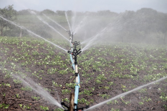
Irrigation Planning and Monitoring
Faulty irrigation systems can be expensive in the long run. Drones equipped with thermal imagers and multispectral cameras can identify problems in irrigation systems. They can also see if the soil is too dry or if it’s getting too much water.
via Pixabay
Land maps created using LiDAR sensors and high-resolution cameras help in the planning and placement of irrigation systems to make sure you get the best results. Using maps created by drones minimizes the need to walk the fields—which saves time and money—and 3D land maps are very detailed and accurate.
Thermal imaging drones can quickly scan large areas of farmland and—because they’re cheaper to operate—they can be used as often as you’d like. Thermal imaging easily identifies soil that’s holding too much or too little moisture.
Thermal imagers detect leaks, clogged emitters, and pressure issues in irrigation systems that threaten crops’ health and wastewater. By finding these problems early, farmers minimize water waste, which saves money and is good for the environment.
Irrigation problems can easily lead to crop failure if they’re not fixed quickly. Drones improve response time by detecting problems faster than in-person inspections. Problems can be mitigated by repairing or replacing faulty irrigation systems as soon as possible.
Final Thoughts
Drones provide lots of benefits in agricultural use. Necessary procedures that used to be highly labor-intensive can now be done much easier when drones are used. To learn more about how you can save money and get better results by using drones, get in touch with one of our many offices located throughout the southern US.