
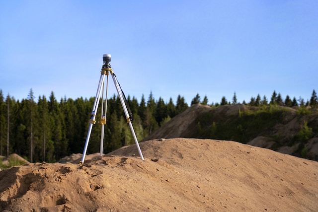
Land surveying plays a vital role in construction projects, serving as the foundation for accurate planning, design, and implementation. It involves the measurement, mapping, and analysis of land, ensuring that construction activities are carried out efficiently and in compliance with legal requirements.
Multiple types of land surveys are used throughout a construction project to gather essential data and create precise representations of the terrain.
These surveys provide valuable information about the topography, boundaries, and existing infrastructure, enabling engineers, architects, and construction professionals to make informed decisions and mitigate potential risks.
via Unsplash
A few common types of land surveys include but are not limited to boundary surveys, ALTA surveys, and topographic surveys. Boundary surveys establish property lines and legal boundaries using markers and measurements. Topographic surveys detail land features like elevation, vegetation, and structures to assess project feasibility.
ALTA surveys provide comprehensive property information for commercial real estate transactions. These surveys play essential roles in construction projects, ensuring accurate boundaries, evaluating land suitability, guiding construction placement, and facilitating property transactions.
In this article, we will explore the most common types of land surveys that are used in construction projects. You will be empowered to make informed decisions about the types of land surveys that your project requires, and you will gain a deeper understanding of the options that are out there.
10 Common Types of Land Surveys
Boundary Survey
A boundary survey is utilized to determine the precise positions of corners and boundary lines on a land parcel. This survey relies on a combination of recorded legal documents and physical markers to establish the exact boundaries of the land.
Conducting a boundary survey involves comprehensive research both in records and in the field. Its primary purposes include maintaining accurate personal records and identifying the locations of easement lines.
It involves the identification of existing markers and monuments, such as iron pins or concrete monuments, and the measurement of distances and angles to accurately define the property’s boundaries.
ALTA Survey
An American Land Title Association (ALTA) survey is performed prior to property acquisition or home investment and provides a lender or title company with essential survey data necessary for issuing an ALTA insurance policy.
Land surveys such as ALTA surveys are used to provide comprehensive information about a property’s boundaries, improvements, easements, encroachments, and other elements.
These surveys comply with the standards set by the American Land Title Association (ALTA) and the National Society of Professional Surveyors (NSPS) and are often required for commercial real estate transactions.
Topographic Survey
A topographic survey is employed to gain insights into the positions and characteristics of both artificial and natural elements found on a specific land parcel. These elements encompass a wide range of features such as roads, structures, water channels, vegetation, bodies of water, and utility systems.
Architects and engineers who are involved in property enhancement projects frequently rely on this type of survey to inform their design and planning processes. Topographic surveys are an essential type of land survey employed in construction.
These surveys provide a detailed representation of the land’s geological and geophysical features, including elevation changes, contours, vegetation, bodies of water, and man-made structures.
Topographic surveys are crucial in the initial stages of construction projects as they help engineers assess the feasibility of the proposed design and identify any potential obstacles or challenges.
Location Survey
A location survey, resembling a boundary survey, focuses on providing a comprehensive account of site improvements. Unlike a boundary survey that primarily establishes property boundaries, a location survey goes into greater detail, documenting the specific enhancements made to the site.
This type of survey is commonly utilized to fulfil the prerequisites of zoning permits and loan applications, ensuring compliance with regulatory and financial requirements.
Mortgage Survey
Much like an ALTA survey, a mortgage survey is employed during the acquisition of a residence or land parcel. Its purpose is to validate the presence of structures on the property, confirm the ownership of the land and property titles, and ensure compliance with building and zoning regulations prior to finalizing the purchase.
Subdivision Survey
The subdivision survey, as the name suggests, is utilized to partition a larger tract of land into smaller individual sections known as lots. This survey is essential in the process of creating subdivisions, and it must be officially recorded with governmental entities, typically at both the local and state levels.

via Unsplash
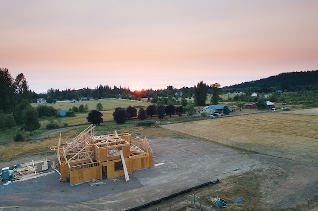
New Construction Survey
Before constructing any buildings, roads, or utilities on a land parcel, a new construction survey becomes essential. This survey involves both vertical and horizontal grading techniques to ensure the accurate positioning of structures.
Vertical positions are determined by comparing elevation differences to a specific reference point on the property known as the benchmark. Horizontal positions, on the other hand, are established by measuring distances between structures.
By conducting a comprehensive new construction survey that incorporates both vertical and horizontal grading, construction professionals can guarantee the precise placement of elements, enabling proper alignment, optimal functionality, and adherence to design plans.
These surveys involve the use of stakes or markers to indicate the positions of buildings, roads, utilities, and other elements based on the project’s design plans. Construction staking surveys help ensure the accurate and proper placement of construction components, facilitating smooth and efficient construction processes.
Environmental Survey
Environmental surveys help determine if a piece of land is safe to build on according to the soil and topography. Sometimes a piece of land may seem perfect to start a project on, but upon a further glance, it may be unsuitable for construction if it includes wetlands, falls within a floodplain, or experiences a high groundwater table.
These conditions would render the land unfavorable for building because of potential environmental challenges and risks, so an environmental survey prior to construction is crucial.
Civil Survey
Civil surveying is an essential engineering process that entails evaluating and documenting information pertaining to a specific land area. This collected data plays a crucial role in assisting the planning and execution of construction projects.
The primary objective of surveying in civil engineering is to ascertain the three-dimensional correlations between various locations, enabling accurate spatial understanding and positioning.
Construction and As-Built Surveys
As-built surveys, often known as record drawings, serve as official records that detail the precise installation of a project. These surveys document the actual outcomes of the construction process, reflecting the completed project as built rather than the initially planned layout depicted in the project design.
As-built surveys play a vital role in project closeout, providing essential documentation of the finished construction for reference and future maintenance purposes.
via Unsplash
FAQs
What is the most common type of surveying?
The most common type of surveying is topographic surveying. Topographic surveys involve the detailed mapping and measurement of the physical features of a land area, including its elevation, contours, natural and man-made features, vegetation, bodies of water, and other relevant characteristics.
These surveys provide crucial information for a wide range of applications, such as urban planning, infrastructure development, engineering projects, environmental assessments, and land management. Topographic surveys are widely used due to their versatility and the comprehensive data they provide about the terrain and its features.
What is the most accurate method of surveying?
The most accurate method of surveying depends on the specific requirements of the surveying task and the available technology. However, one of the most accurate methods widely used today is Global Navigation Satellite System (GNSS) surveying.
GNSS utilizes a network of satellites to provide precise positioning information for surveying purposes. The most well-known GNSS system is the Global Positioning System (GPS), but other systems like GLONASS, Galileo, and BeiDou are also available.
What is the most rapid method of surveying?
The most rapid method of surveying depends on the specific requirements and the available technology. However, one of the most rapid methods widely used today is aerial surveying using unmanned aerial vehicles (UAVs), also known as drones. Aerial surveying with drones offers significant advantages in terms of speed and efficiency.
Drones equipped with high-resolution cameras or LiDAR sensors can quickly capture aerial images or generate detailed 3D point clouds of the surveyed area. This allows for rapid data collection over large areas, reducing the time required for traditional ground-based surveys.
What method is used to survey a large area of land?
When surveying a large area of land, one of the commonly employed methods is aerial surveying. Aerial surveying utilizes various techniques to gather data from an elevated perspective, covering expansive areas in a relatively short amount of time.
Final Thoughts
Land surveys play a crucial role in construction projects by providing accurate data on boundaries, topography, and other essential elements.
The types of land surveys used in construction, such as boundary surveys, topographic surveys, construction staking surveys, and ALTA/NSPS surveys, contribute to efficient planning, design, and implementation of construction activities, ensuring compliance with legal requirements and minimizing potential risks.
To learn more about land surveys and other preemptive safety tools we use in engineering, head over to our engineering page.