Surveying is a crucial part of both civil engineering and environmental engineering for many different projects – but it is especially important when it comes to the oil and gas industry. Any undertaking in the oil and gas field will likely begin with a survey. And in recent years, the results of these surveys have become more and more illuminating.
Oil and gas surveyors in today’s climate are able to harness new and increasingly advanced technologies and tools in order to provide clients with the most accurate and detailed data possible about any project an organization is taking on. Oil and gas surveying is important in both the public and private sectors, and it’s often a legal requirement.
Before you start any oil and gas project, it’s crucial to make sure that you are covering your bases and conducting the appropriate surveying. Oil and gas projects often involve both geological and geophysical surveys. In this article, we will be diving deeper into the latter option. Geophysical surveying offers numerous benefits, which we will explore here.
What Is a Survey in Oil and Gas?

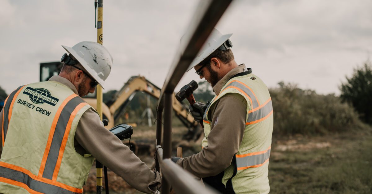
via Pexels
In the simplest terms, surveying in the oil and gas industry involves mapping out the area around the designated location of a project that is set to begin soon. This isn’t just a typical map, however. Oil and gas surveying often involves investigating a range of terrestrial features, both surface-level and subsurface.
When you conduct the appropriate surveying before beginning a project, you will see numerous benefits. Surveying and understanding the area you are working with will help you foresee any future complications or potential obstacles before you even begin the project. That means that you will be able to plan ahead to achieve the best results.
Benefits of Surveying in Oil and Gas
Surveying in the oil and gas industry offers a whole host of benefits. Let’s dive deeper into how exactly your project will benefit from conducting the appropriate surveying, geophysical surveying included.
One of the primary benefits of oil and gas surveying is ensuring that your project adheres to its proposed deadlines. If you do not conduct a survey before beginning the project, you will not have all of the information you need to make accurate predictions about how long a project will take. Surveying enables you to understand the timetables of these endeavors.
Surveying is also an excellent tool to help you consider the quality of the construction as well as the location of your oil and gas project. Conducting effective surveying from the get-go is the best way to ensure your pipeline, rig, or other operation is up and running in as little time as possible. When you survey first, you’ll save later – time, money, and energy.
Oil and gas surveying helps companies and teams build better infrastructure. After all, isn’t the goal to make your project output last as long as possible? This is just one of many places where civil engineering and surveying overlap. Both disciplines require robust data collection in order to create long-lasting, environmentally friendly, and efficient infrastructure.
Let’s not forget the role that surveying plays in promoting best practices when it comes to safety. Initial surveying will typically be completed in a project’s early stages, but it can also be reviewed throughout the steps of the project to ensure that all stakeholders and construction teams remain safe in the working environment.
It’s important that the development of oil and gas projects rolls out with safety in mind – and at the forefront. But safety doesn’t have to be costly. Surveying can help organizations determine the paramount safety measures that must be taken to ensure that the project is completed with minimal risk to the company and construction crew.
That can go hand in hand with prioritizing cost-effective solutions and ensuring the operation upholds integrity from a project management perspective. No matter what, though, it is critical that your oil and gas project is safe and secure. As anyone who is familiar with the industry knows, the oil and gas field has received significant pushback for environmental damage.
Surveying can help prevent environmental harm as well as physical and personal harm. Plus, it can actually help organizations make their oil and gas projects environmentally beneficial. Building wells and pipelines that are made to withstand years of continuous use is actually a service to the environment. Well-constructed projects like this are much safer, of course.
And it’s not just about environmental safety – surveying promotes “safety” for your wallet too. When you get all the information you need, enabling your organization to create high-quality oil and gas projects that are built to last, you will cut down on expensive repairs and future maintenance costs.
Safety begins on an individual level and stretches to extend to an environmental level. Surveying helps ensure best practices across this entire reach. In other words, proper surveying can help both individuals and the planet remain safe.
In sum, oil and gas surveying is an important part of the pre-development process of any project in the industry. Why? It can help you avoid costly or dangerous issues down the road. Here are a few of the benefits you can expect to see when you survey before beginning an oil and gas project:
- Adhering to deadlines
- Building better, longer-lasting infrastructure
- Ensuring safe practices
- Minimizing environmental harm
- Finding cost-effective solutions
What Do You Learn From Oil and Gas Surveying?
Now that you understand what kinds of benefits oil and gas surveying can provide, you’ll need to know more about the actual data that you will be discovering. When you pass your project’s oil and gas surveying over to a qualified, respected firm like Fenstermaker, you will be able to get a full visual on features and information such as:
- Other companies that are drilling nearby
- The locations of pre-existing pipelines
- The locations of access roads and other transport considerations
- The coordinates of major landmarks and topographical features
- Both surface and subsurface land materials
Getting this level of detailed data from the onset of the project will allow your team to generate a more complete understanding of your site area. You will also gain insight into potential obstacles that could stand in your way.
Understanding these future hindrances can help you account for those problems from the outset in ways that will be cheaper and less time-consuming than fixing issues as you go.
What Is a Geophysical Survey in Oil and Gas?
Unlike their counterparts geological surveys, geophysical surveys are exclusively focused on collecting information about a site’s subsurface features. You may have heard of this methodology before in the field of archaeology, but it is also highly important to the world of civil and environmental engineering.
One important consideration when it comes to geophysical surveys is that they aim to be neither invasive nor destructive. In order to accomplish that goal, geophysical surveys typically involve tools such as sensors that allow surveyors to collect the necessary subsurface information.
There are many different types of sensors available to geophysical surveyors. The sensor that they choose will depend on the type of environment they are exploring. For instance, there are unique sensors for surveying air, water, and land.
Types of Geophysical Surveys
Geophysical surveys come in a few different varieties. The type of survey is usually determined by looking at the type of environment the survey will explore and the tools that will be required for the job. Each type of survey has unique applications and associated equipment. They can be conducted from the air, on the ground, or down in drill holes.
Airborne geophysical surveys can involve magnetic, gravity, radiometric, or electromagnetic surveys. They will typically also require helicopters or other light aircraft arranged in a grid pattern. Ground-based surveys may use similar sensors, but the execution will be different. Let’s take a look at a few of the geophysical surveying options.
Ground-Penetrating Radar (GPR)
This tactic involves sending an electromagnetic pulse into the ground. Subsurface objects cause reflections in that pulse, and the data gets sent back to the surveyors. With these results, surveyors can determine the depth of a given object based on calculations involving the travel time of the electromagnetic pulse.
GPR is typically used when a project site has sandy soil. That’s because soil that has high levels of clay, silt, or certain other materials may cause metallic interference and mess up the electromagnetic pulse.
Seismic Surveys
In seismic surveying, technicians will arrange geophones – sensors connected to wires – in strategic matters. Then, they will create vibrations using truck-mounted vibrating weights (or, in some cases, small explosives). The geophones will be able to read and measure the vibrations as they pass through Earth’s layers, and surveyors will be able to interpret this information to collect data about rocks even miles underneath the surface.
Radiometric Surveys
Conducted from the air or just above the ground, radiometric surveys measure Earth’s gamma rays. The Earth continuously emits these rays due to the natural decomposition of radiogenic materials. Radiometric surveying allows technicians to identify metallic or industrial minerals present at a site.
Magnetic Surveys
This tactic involves investigating variations in Earth’s magnetic field. These variations occur because of the presence of magnetic minerals. So why is this information useful? Well, it allows geophysical surveyors to gain knowledge about the rock types under the ground and assist with identifying different possible resources.
Does a Geophysical Survey Require Drilling?
Some geophysical surveys may require drilling, but only in small areas. Drilling is more common as part of geological surveying. Remember, geophysical surveying aims to be as noninvasive as possible. Plus, geophysical surveyors have advanced technology that allows them to gain information about subsurface materials without penetrating the Earth.
When drilling does occur, the process involves breaking through the ground in order to extract rocks from various depths beneath the Earth’s surface. Why do oil and gas projects benefit from this information? Well, it can be important to confirm the underground geology of a site and provide samples for chemical analysis.
Drilling, when it is used, helps technicians and engineers determine the types and structures of the rocks that are the foundation of our oil and gas projects. In this industry, understanding the makeup of the land beneath a project is crucial for infrastructure longevity.
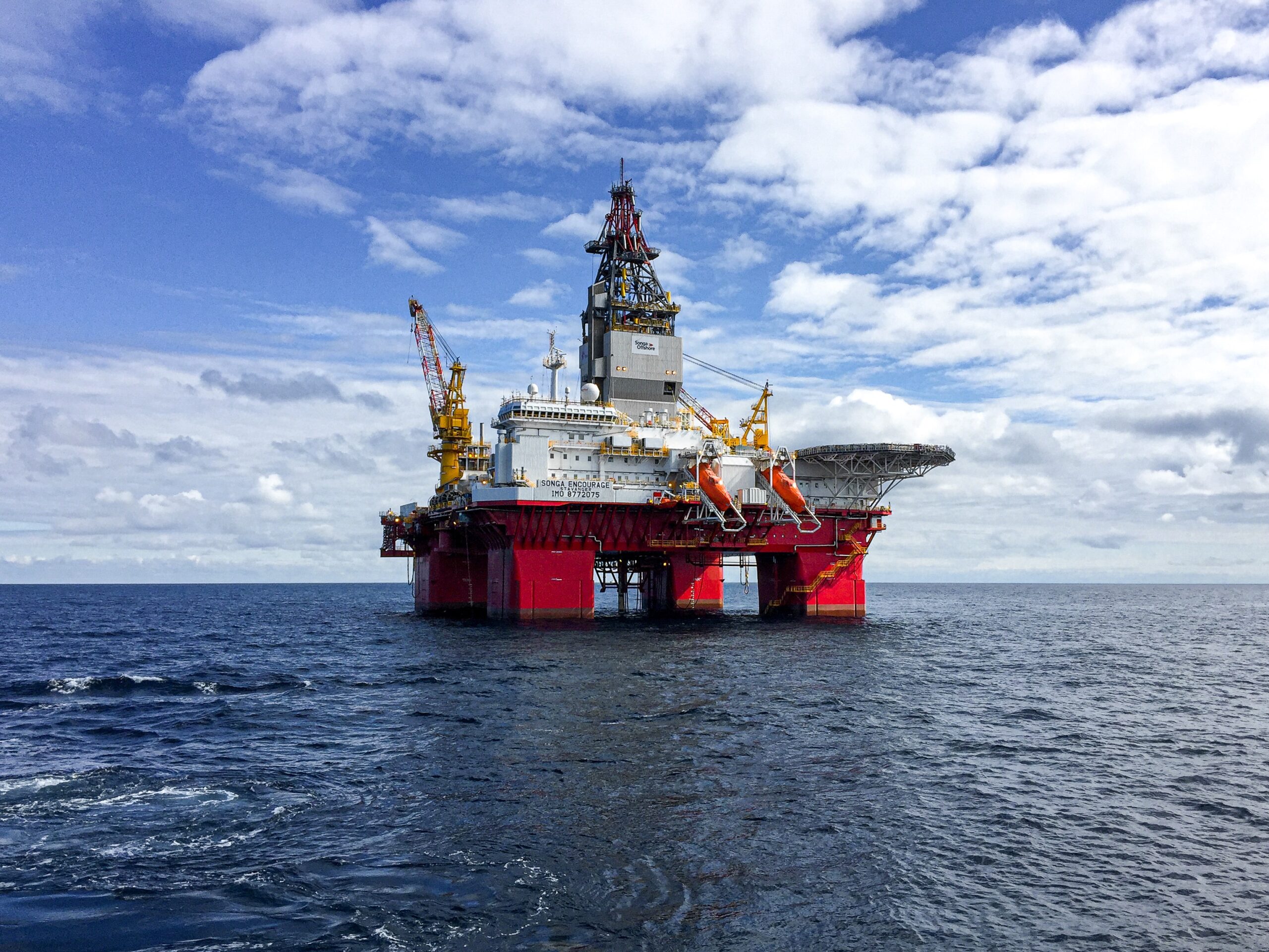
via Pexels
What Skills Do You Need to Be a Surveyor in Oil and Gas?
To be a surveyor in the oil and gas industry, you’ll need to have strong analytical, interpersonal, and communication skills, among others. Geological or hydrologic technicians are the people who conduct oil and gas surveys, although petroleum engineers may also be involved in this job.
So what do they do? These technicians support engineers and scientists in tasks like exploring, extracting, and monitoring the natural resources of our planet.
When it comes to education, you will need at least an associate’s degree to be a surveying technician. Degrees in applied sciences or science-related technology are the most relevant in the field. While some employers require a bachelor’s degree, many organizations in the business of geophysical surveying will offer robust on-the-job education and training.
If you do have a bachelor’s degree, you might be additionally qualified for positions that are particularly data intensive or involve more technical skills. In terms of where to get your degree, community colleges and technical institutes across the U.S. offer programs in geosciences, mining, or relevant topics like geographic information systems (GIS).
As you pursue a degree on the way to becoming a surveying technician, you most likely participate in courses about mathematics, computer science, geology, physics, and chemistry – and more. Some collegiate programs offer internships and other opportunities so that aspiring surveying can gain real-world experience while in the process of gaining degrees.
Plus, many of the skills you will need to be an oil and gas are transferable skills. In other words, you might pick them up by working in other industries. Those skills include:
- Communication skills: you will need to explain your findings and methods to scientists, engineers, managers, stakeholders, and other technicians. It’s important that everyone involved grasps the data given in an oil and gas survey, so surveying technicians may be asked to share both oral and written reports.
- Analytical skills: if you work as a surveying technician, you need to be able to evaluate data and other samples using a variety of techniques and equipment, such as laboratory experimentation or computer-based modeling.
- Critical-thinking skills: it’s crucial to use your best judgment to determine which data is relevant to the project at hand. Then you will interpret that data as best you can.
- Physical ability: oil and gas surveyors will often be expected to conduct fieldwork. That can involve traveling to remote locations and carrying heavy equipment for testing and sampling.
- Interpersonal skills: surveyors work with many other individuals in various roles when they are in the field and on various jobs. With that in mind, you will want to prioritize teamwork and collaboration to get the job done.
Anyone who has these skills and an interest in the oil and gas industry should consider a career in surveying. The field offers competitive pay, averaging about $50,080 per year, and the demand for these jobs continues to increase at a rate of 4% per year.
What Types of Data Does a Surveyor Collect in Oil and Gas?
Surveyors in the oil and gas industry are tasked with collecting a wide range of data, including the locations of access roads, water resources, and other drilling sites in the area. The information they provide helps companies make informed choices about their projects.
Some of the data that surveyors collect will be broad, while other pieces of it will be more specific and scientific. You can expect to see data on topics like:
- Other companies drilling nearby
- Places where other pipelines are located
- Landmarks and topographical features
- Access roads
- Subsurface and surface materials
- Environmental hazards
- Water resources
- Types of rocks and structure of subsurface terrain
When it comes to the information that you learn from oil and gas surveying, the list is almost endless. After the fact, surveyors will put this data into a report format so that you can use the findings of the survey to make informed decisions about your project.
Final Thoughts
Geophysical surveys are important pieces of any oil and gas project, and they should be completed early on. They offer a multitude of benefits, including helping the project meet deadlines, building lasting infrastructure, ensuring safe practices, lessening environmental danger, providing both surface and subsurface data, and more.
To make sure that your oil and gas project goes according to plan, you will need to choose a qualified, experienced firm like Fenstermaker to tackle your surveying needs.