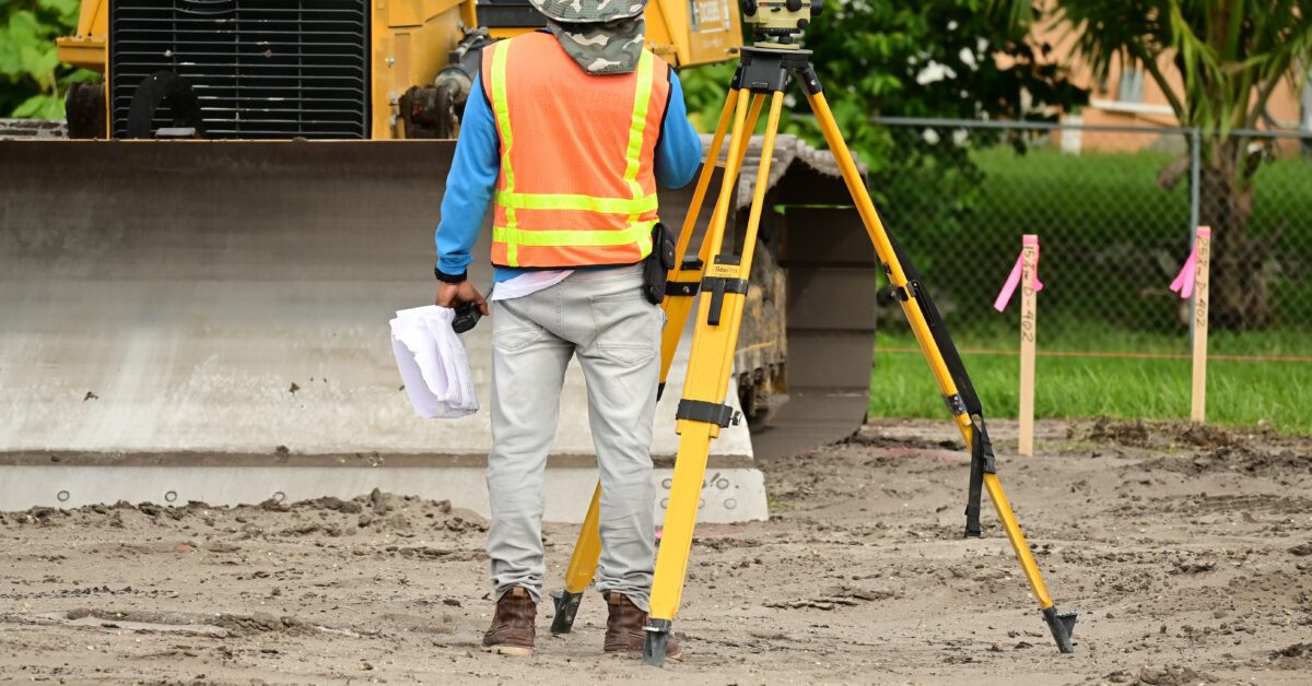
Many engineering projects can benefit from geological or geophysical surveys. These are two different methods that qualified firms and individuals can use in order to investigate the quality of the land and subsurface materials on the sites of new buildings or public works projects.
Not to be confused with a typical land survey, geological and geophysical surveys yield a wide breadth and depth of information, and they can be conducted by both state or national organizations as well as by private firms. In order to fully understand the makeup of the land or area for a project, surveying is often a necessary step.
So what are each of these types of surveys, and where do they overlap and differ? What are the advantages of each one? In this article, we will be answering all of those questions and more. If you think that your organization could benefit from a geological or geophysical survey, you are in the right place.
What Is a Geological Survey?

via Pixabay
Geological surveying involves investigating the geology of the surface and subsurface of a given site. Generally speaking, these surveys are conducted with the purpose of building a geological map or model of an area. Geological surveys involve many different tactics, both intrusive and surface-level.
Geological surveys are highly important to the world of civil and environmental engineering, and they help to provide crucial information about projects in numerous different fields, including oil and gas, water resources, coastal, and so many more.
What Is Geology?
In broad strokes, geology is the study of the structure of the Earth, both on and underneath its surfaces, and the ongoing processes that have contributed to that structure. For instance, a geologist might investigate the mineralogical composition of rocks so as to gain information about their history. In this way, geologists are able to chronicle the history of our planet.
Modern-day geology is even further reaching. These days, geology is crucial when it comes to evaluating water resources, remediating environmental issues, understanding naturally occurring hazards, and providing insights into climate change. It’s also closely linked to the world of civil and environmental engineering.
In order to understand the purposes of a geological survey, it’s crucial to dive deeper into the science of geology. This is a subfield of natural science that is concerned with studying planet Earth, specifically the study of the rocks that comprise its mass and the ways in which those rocks have changed over time and may change again in the future.
Geology in Engineering
Engineering geology refers to the tactic of applying geological principles to engineering practices. Why? This can help civil engineers ensure that they properly address geological factors that might affect the site, design, construction, operation, and ongoing maintenance of projects they are working on.
Geological principles and analysis are frequently applied to civil engineering projects. Surveys can help civil engineers discover the mechanical properties of the material on which they are planning to build a structure. This is what allows us to build tunnels that don’t collapse, bridges and skyscrapers on secure foundations, and structures that don’t sink in clay or mud.
Geological engineering is a subfield of engineering that’s focused on applying geological science and engineering principles to fields like environmental engineering, mining, civil engineering, forestry, conservation, oil and gas, and others. Geological engineers do work that supports individuals in other branches of engineering by conducting geological surveys.
Geological Surveys
Now that we have established an understanding of the role of geology in engineering, we can further explore the meaning and impact of geological surveys. A geological survey refers to the systematic investigation of the geology underneath a given site. These surveys are typically conducted with the aim of generating a geological map or model.
Geological surveying relies on some techniques that evoke typical land surveying, such as walk-over tactics and studying outcrops and landforms. Geological surveys may also use more intrusive methods, like hand augering and machine-driven boreholes.
With the advent of new technology in the field, there is also the opportunity to use remote sensing methods like aerial photography and satellite imagery. These types of surveys are often conducted by state, provincial, or national surveying associations. However, for civil engineering projects, geological surveys can also be conducted by private firms.
The geological data gained from these surveys can provide useful information about both surface and subsurface conditions. This information is applicable to numerous projects including civil works, exploring natural resources, mitigating environmental problems, and transportation.
What Is a Geophysical Survey?
Geophysical surveys involve collecting information associated with subsurface features. This is an important archeological methodology, but it’s also relevant to the fields of civil and environmental engineering. An important feature of geophysical surveys is that the methods are not invasive or destructive.
In order to accomplish this goal of being noninvasive, geophysical surveys rely on tools like sensors in order to collect the necessary subsurface information. There are many different types of sensors the geophysical surveyors can use depending on what type of environment they are exploring – air, water, or land.

via Pexels
Types of Geophysical Surveys
There are many different varieties of geophysical surveys, typically determined by what environment the survey is exploring and what tools will need to be used. Each of these types has different applications and equipment, and they can be conducted from the air, on the ground, or down in drill holes.
Airborne geophysical surveys can involve magnetic, gravity, radiometric, or electromagnetic surveys, and they are usually executed by way of helicopters or other light aircraft arranged in a gridlike pattern. Ground-based surveys can take many different but similar forms. Let’s explore a few of those common methodologies.
Seismic Surveys
This type of geophysical surveying involves arranging geophones, which are sensors connected to wires, in strategic patterns. The surveyors will then create vibrations using small explosives or truck-mounted vibrating weights, which the geophones will be able to read and measure as they pass through the Earth’s layers. This will allow for the collection of information about rocks miles below the surface.
Ground-Penetrating Radar
Ground-penetrating radar, also abbreviated as GPR, involves sending an electromagnetic pulse into the ground. Subsurface objects then cause reflections in the data that gets sent back to the surveyors, who can discover the depth of a given object based on information about the travel time of the electromagnetic pulse.
GPR is most often used in environments with sandy soil. That’s because soil with significant amounts of clay, silts, or certain other materials can cause metallic interference – in other words, it will mess with the electromagnetic pulse.
Magnetic Surveys
This type of geophysical surveying involves investigating variations in Earth’s magnetic field that occur because of the presence of magnetic minerals. These small variations allow geophysical surveyors to glean information about rock types and assist with identifying different resources.
Magnetometers are one of the tools used in this process. They are able to provide better resolution of small features that are near the surface. Magnetometers are able to respond strongly to iron, steel, burned soil, brick, and other types of rock.
Radiometric Surveys
This type of geophysical survey measures the gamma rays that Earth continuously emits due to the natural decomposition of radiogenic materials. This strategy can be conducted from the air or directly above the ground, and it allows surveyors to identify metallic and industrial minerals in the Earth.
These are just a few of the many different types of geophysical surveys that can provide civil and environmental engineers with important information about the sites on which they are working.
What Is the Difference Between a Geophysical and Geological Survey?
One of the main differences between geophysical and geological surveys is that geophysical surveys are solely focused on the surface of the Earth, while geological surveys can include surface-level and subsurface-level information. Geophysical and geological surveys have a lot in common, but they also have some key differences.
It’s important to understand both the similarities and differences between these two methodologies to grasp which one is a better option for your project.
Similarities Between Geophysical and Geological Surveys
Some of the similarities between these two methods include:
- Both methods study the Earth with the aim of gaining information that helps civil engineering design, plan, and build complex projects
- Both can be used to find and develop oil and gas fields as well as mining locations for industrial minerals and precious metals
- Both can assist with increasing our supply of fresh, usable groundwater
- Both surveys should yield site assessments and characterization reports
- Both geophysicists and geologists will have robust training in the physical sciences
- Both types of surveys produce findings used to make interpretations and decisions about a worksite
Differences Between Geophysical and Geological Surveys
Some of the differences between these two methods include:
- Geological surveys determine the location, composition, and orientation of Earth’s naturally occurring materials
- Geophysical surveys yield measurements about physical properties like electricity, magnetism, and gravity
- Geological surveys can be invasive, but geophysical surveys are neither invasive nor destructive
- Geological surveys focus on both surface and subsurface discoveries whereas geophysical surveys are focused fully on subsurface information

via Pexels
What Are the Advantages of a Geological Survey?
Some of the advantages of a geological survey include the fact that it is less expensive, it can reveal a greater amount of information, and the data can be used for many different applications. A geological survey will be conducted by someone who specializes in a field like engineering geology, environmental geology, or hydrogeology.
These individuals are highly trained in exercises like locating and developing gas, oil, and mineral deposits. Geologists conduct both surface and subsurface surveys that allow them to investigate Earth’s materials and history.
Geologists will be able to harness their findings and data in order to provide interpretations of what they have found that can inform decisions about construction sites or locations for large-scale public works projects.
Because geological surveys involve both surface and subsurface investigations, they may provide a wider range of data. However, the tools available for geological surveying are not always as robust as those used for geophysical surveying when considering subsurface data. On the other hand, that can cut back on costs when detailed below-ground information is less necessary for a project.
To recap, the advantages of a geological survey typically include…
- Wide breadth of information on both surface and subsurface qualities
- Cost savings accompany less complex technology
- Range of applications, including science about natural hazards, water, energy, minerals, other natural resources, environmental health, and climate change and land-use impacts
- Diverse data to cover many different bases
What Are the Advantages of a Geophysical Survey?
Geophysical surveys are advantageous because they invoke many different technologies in order to determine the geological, structural, physical, and mechanical characteristics of the Earth’s soil. These methods are typically employed to discover properties of layers below the terrain surface on the site where the construction of a given structure is planned.
The scope of a geophysical survey as well as its method types and techniques will depend on the purpose of the survey as well as the funds available and the topographic conditions of the site. Generally speaking, these surveys can offer significant savings in terms of both time and economic resources and provide large volumes of data compared with other methods.
To recap, the advantages of a geophysical survey typically include…
- Focus on subsurface information
- Overall less invasive methods
- Savings of time and money compared to traditional methods
- Larger volumes of data
- Advanced technology yields high-quality data
Final Thoughts
Both geological and geophysical surveys yield plenty of important information about the site where a project is going to be built. It can be important for civil engineers to understand the makeup of the land and its subsurface qualities, as this can inform key decisions about structure, building materials, tension, and more.
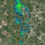
Geological and geophysical surveys can also help civil engineers and construction companies (as well as other stakeholders) ensure that their decisions are taking the health of the planet and environment into account. These surveys can help predict floodplain patterns as well as other water resource information that may be crucial to understand.
If you are taking on a civil engineering project, conducting the right surveys is highly important. Our team at Fenstermaker can help you learn more about which surveys are right for you and your organization.