The oil and gas industry is a critical sector of the global economy. It plays a pivotal role in meeting the world’s ever-growing energy demands. When we say oil and gas, we are talking about a field that encompasses the exploration, extraction, production, refining, and distribution of petroleum and natural gas.
These energy sources are at the core of everyday life from powering transportation to generating electricity and heating homes. Although the first drilled oil well wasn’t developed until the mid-1800s, in just two and a half centuries, we have come to rely heavily on this source of fuel and it is now a widely-used pillar of modern life.
Characterized by its cyclical nature, the oil and gas industry is often influenced by global oil prices, geopolitical events, technological advancements, and shifting energy policies. As the world continues to seek alternative and renewable sources of energy, the oil and gas industry is evolving and adapting to changing dynamics while continuing to play a vital part in meeting the world’s energy needs.
The industry is often split up into three segments, upstream (the business of oil and gas exploration and production), midstream (transportation and storage), and downstream (refining and marketing). Surveying is required in each segment, and engineers play a key part in each aspect of surveying.
So how does oil and gas surveying work and what tools or skills make a successful surveyor? In this article, we will dive into these questions and more, uncovering one of the major roles of engineers in the oil and gas industry.
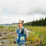
How Does Surveying Work?

via Unsplash
Surveying involves the use of specialized tools, instruments, and methods to collect accurate data for various purposes, such as land development, construction, mapping, and resource management. It is a technique used to measure, map, and describe the physical features and dimensions of land, objects, or structures.
Typically, surveyors conduct a preliminary assessment of the survey area to identify existing features and potential obstacles. Next, surveyors establish a control network using established benchmarks. These are important steps at the start of any project.
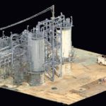
Once the control network is established, surveyors use a variety of instruments to measure distances, angles, and elevations. These may include total stations, GPS receivers, levels, drones, and theodolites. These instruments are used to collect data points that are then processed to create accurate maps, plans, and models.
Other surveying techniques may include photogrammetry, which uses aerial or terrestrial photographs to create 3D models, and LiDAR (Light Detection and Ranging), which uses lasers to measure distances and create highly detailed maps.
Modern surveying often involves the use of computer-aided design (CAD) software to process and analyze data, and geographic information systems (GIS) to integrate survey data with other spatial data for analysis and visualization.
Accurate surveying is crucial in many fields, including civil and environmental engineering. It provides critical information for making informed decisions, managing resources, and ensuring the safety and efficiency of construction projects.
In the oil and gas industry, there are many common survey types that can help civil engineers, construction companies, and other stakeholders ensure that their decisions are taking the health of the planet and environment into account. These surveys can help predict floodplain patterns as well as other water resource information that may be crucial to understand.
Surveying can yield information about both surface and subsurface terrestrial features – and it can be used for offshore projects too. Surveying in the oil and gas industry refers to the process of mapping out the area around the location designated for a project. This has plenty of benefits and will help you achieve the best results (in terms of both profit and other factors).
What Is the Main Purpose of Surveying?
The main purpose of surveying is to accurately measure, map, and describe the physical features and dimensions of land, objects, or structures, all of which are crucial to the completion of an engineering project. Surveying serves multiple other purposes as well.
In the oil and gas industry, surveying is also an important part of the pre-development process of any project. That is because it can help you avoid costly and dangerous issues down the road. These are just a few of the benefits of surveying that you should consider before beginning your oil and gas project:
- Staying on deadline
- Building better, more effective infrastructure
- Promoting and following safe practices
- Minimizing harm to the environment
Surveying has many different applications – and they aren’t just limited to the oil and gas world. Let’s dive a little deeper.
Land Development
Land surveyors help determine property boundaries, create topographic maps, establish reference points, and design infrastructure such as roads, buildings, and utilities. Land surveying helps in assessing the feasibility of a project and ensures that it is constructed according to approved plans and regulations.
Construction
Construction projects use surveying to provide precise measurements for setting out building foundations, grading and leveling, and verifying the alignment of structures. It ensures that buildings and structures are constructed accurately and in compliance with design specifications.
Mapping and Geographic Information Systems (GIS)
Surveying is used to create accurate maps, charts, and geographic data crucial for applications such as land management, urban planning, environmental monitoring, and disaster management. GIS combines survey data with other spatial data for analysis, decision-making, and visualization.
Resource Management
Natural resource management uses surveying to measure and map features such as forests, water bodies, and mineral deposits. It helps assess the availability and sustainability of resources, allows organizations to plan for their efficient utilization, and facilitates the management of environmental impacts.
What Are the Types of Surveying in Oil and Gas?
There are several types of surveying that are commonly used in the oil and gas sector, such as topographic and pipeline surveying, that are extremely helpful within the engineering field. Surveying plays a crucial role in the oil and gas industry, supporting exploration, production, and transportation activities.
Topographic Surveying
Topographic surveying is used to create detailed maps that represent the natural and man-made features of the land, including elevations, contours, water bodies, vegetation, and structures. Topographic surveys are essential for site selection, designing facilities, and planning access roads and pipelines.
Construction Surveying
Construction surveying is used during the construction phase of oil and gas projects to set out the locations of facilities, pipelines, access roads, and other infrastructure. Construction surveys ensure that facilities are built according to design specifications and regulatory requirements.
Pipeline Surveying
Pipeline surveying involves the measurement and mapping of pipelines, including their alignment, elevation, and location. Pipeline surveys are critical for designing and constructing pipelines, monitoring pipeline integrity, and ensuring compliance with safety and environmental regulations.
Geological Surveying
Geological surveying involves investigating the geology of the surface and subsurface of a given site. These surveys are typically conducted with the intent of building a geological map or model of an area. Geological surveys involve many different tactics, both intrusive and surface-level, and some will require drilling.
Geophysical Surveying
Geophysical surveying is focused on collecting information about a site’s subsurface features – or what’s underground. One important consideration when it comes to geophysical surveys is that they aim to be neither invasive nor destructive.
In order to accomplish that goal, geophysical surveys typically involve tools such as sensors that allow surveyors to collect the necessary subsurface information. There are many different types of sensors available. The right one for the job depends on the type of environment being explored. For instance, there are unique sensors for surveying air, water, and land.
What Skills Do You Need to Be a Surveyor in Oil and Gas?
Being a surveyor in the oil and gas industry requires a diverse skill set that combines technical expertise, field experience, and industry-specific knowledge. In this section, we will cover some of the most common skills you will need in the field of oil and gas surveying.
Geomatics and Surveying Techniques
A solid understanding of geomatics principles, surveying techniques, and equipment is essential for accurate measurement, mapping, and data collection. This includes knowledge of GPS/GNSS, total stations, laser scanners, and other surveying tools and technologies.
Spatial Data Analysis and GIS
Proficiency in spatial data analysis and Geographic Information Systems (GIS) is crucial for processing, analyzing, and visualizing survey data in the context of project requirements. Knowledge of GIS software, data management, and spatial analysis techniques is valuable for interpreting and utilizing survey data effectively.
Offshore and Onshore Surveying
Surveyors in the oil and gas industry may work both offshore and onshore and will need to be skilled in both environments. This includes understanding the challenges and safety protocols associated with working offshore, such as offshore navigation, positioning, and safety procedures.
Construction and Engineering
Familiarity with construction and engineering principles is important for understanding project plans, specifications, and design requirements. Surveyors may need to set out construction points, verify as-built measurements, and ensure compliance with design and regulatory standards.
Data Interpretation and Analysis
Strong analytical skills are crucial for interpreting and analyzing survey data, including measurements, maps, and other geospatial information. Surveyors need to identify and resolve discrepancies, errors, and uncertainties in data, and provide accurate reports and recommendations.
Communication and Teamwork
Effective communication and teamwork skills are vital for collaborating with other professionals, such as engineers, geologists, and project managers, to ensure seamless coordination and successful project outcomes. Surveyors also need to communicate clearly with clients, stakeholders, and field personnel.
Problem-Solving and Adaptability
Surveying can involve encountering unexpected challenges in the field, such as difficult terrain, adverse weather conditions, or equipment malfunctions. The ability to think critically, solve problems, and adapt to changing situations is essential for overcoming obstacles and achieving surveying objectives.
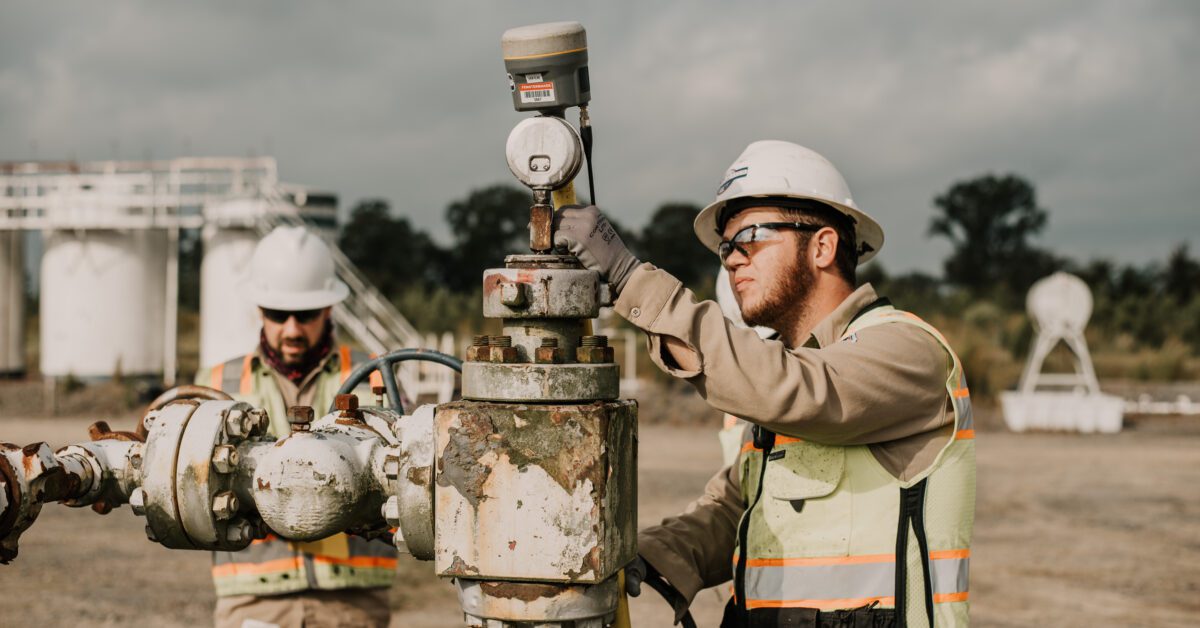
What Types of Data Does a Surveyor Collect in Oil and Gas?

via Unsplash
A surveyor in the oil and gas industry collects a wide range of data to support various aspects of oil and gas operations, including exploration, production, transportation, and environmental monitoring. While the key types of data may vary by project, below is a list of useful data collected during surveying.
Geospatial Data
Surveyors collect geospatial data, which includes precise measurements of positions, elevations, distances, and angles using GPS/GNSS, total stations, and other surveying tools. This data is used to create accurate maps, plans, and models of the terrain, facilities, pipelines, and other assets.
Wellbore Data
Surveyors collect wellbore data, including the inclination, azimuth, and depth of wellbores during drilling operations. This data is critical for wellbore placement, trajectory tracking, and wellbore integrity monitoring.
Pipeline Data
Surveyors collect pipeline data, including the alignment, elevation, and location of pipelines. This data is used for designing, constructing, and monitoring pipelines, as well as assessing pipeline integrity and compliance with safety and environmental regulations.
Topographic Data
Surveyors collect topographic data, which includes elevations, contours, vegetation, water bodies, and structures. This data is used for site selection, designing facilities, and planning access roads and pipelines.
Bathymetric Data
Surveyors collect bathymetric data, which includes the depth, shape, and features of the seafloor. This data is used in offshore oil and gas projects for site selection, pipeline routing, and environmental impact assessments.
Construction Data
Surveyors collect construction data, including the locations and dimensions of facilities, pipelines, access roads, and other infrastructure during the construction phase of oil and gas projects. This data is used to ensure that facilities are built according to design specifications and regulatory requirements.
Subsea Data
Surveyors collect subsea data, which includes measurements and mapping of underwater features, structures, and facilities using specialized equipment and techniques. This data is used in subsea construction, installation, and maintenance of offshore oil and gas infrastructure.
Final Thoughts
The oil and gas industry is crucial in the function of daily life and society. Surveying makes sure that the structures and resources engineers build and access during development are safe, efficient, and sustainable.
If you are taking on a civil engineering project, conducting the right surveys is highly important. Our team at Fenstermaker can help you learn more about which surveys are right for you and your organization.