
As technology has advanced in recent years, the amount of software used in civil engineering and design has increased substantially. Civil engineers design, manufacture, and maintain both natural and manmade infrastructures including dams, bridges, roads, airports, parks, pipelines, railways, power plants, water treatment facilities, sewage systems, and stadiums.
The size and cost of these projects can vary greatly in scale, and they can be in either the private or public sector. This is to say that the software needs of civil engineers are quite diverse, and there are many different programs out there to aid civil engineers across various projects.
In this article, we will explore the best civil engineering software programs, some of which you may not have heard of yet. We will provide a thorough overview of what’s out there as well as what each program is best suited for, who uses it, and its strengths and weaknesses.

via Unsplash
What is Civil Engineering Software?
Civil engineering software refers to the range of tools designed to aid civil engineers throughout the design and construction processes of different projects. There are software programs for every project stage, including drafting, documenting, designing, visualizing, and analyzing.
These software programs are specialized for designing and overseeing larger-scale projects like buildings, transportation systems, bridges, and dams. They can calculate the building costs as well as the management costs associated with each project. They can also predict the time and resources needed for any given undertaking.
via Unsplash
The following programs help civil engineers with their jobs on a daily basis—whether they’re working on modeling pipe networks, drafting the plans for a new community center, or ensuring an ongoing project stays on schedule, these programs are essential to the world of civil engineering.
19 of the Best Civil Engineering Software Programs
Most of these 19 programs are workplace essentials for many civil engineers. If you’re already in the field, this article can help you find the right software to streamline your day-to-day work. If you’re interested in getting into the field of civil engineering, you may want to explore these software programs and become comfortable using them. They’re sure to help you excel.
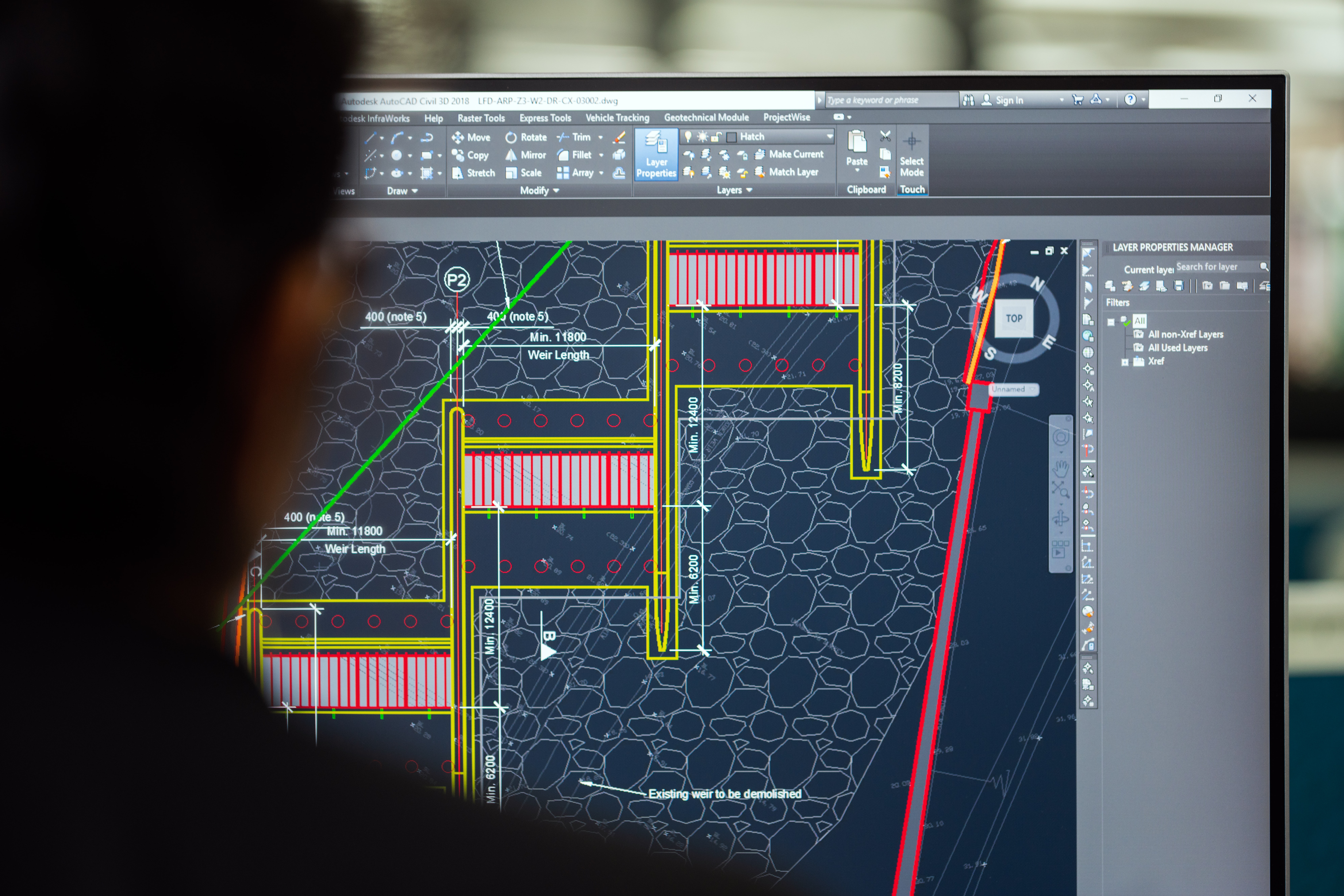
AutoCAD Civil 3D
A civil engineering drafting software with many different design, analysis, and simulation tools specially made for civil engineering projects, AutoCAD Civil 3D is undoubtedly the most common program within the industry. Understanding how it works is essential for most careers in civil engineering.
CAD can be used to create sets of plans that are commonly known as construction documentation. Whether it’s polylines or feature lines, pipe networks, or profiles, Civil 3D has a range of tools that allow you to create detailed, innovative designs that are sure to shine.
It boasts streamlined documentation with a design-driven approach to plan production and the ability to work with a model-based environment that enables superior design decisions and improved project quality. Additionally, AutoCAD Civil 3D allows users to harness the power of BIM (Building Information Modeling), enabling design coordination and project collaboration.
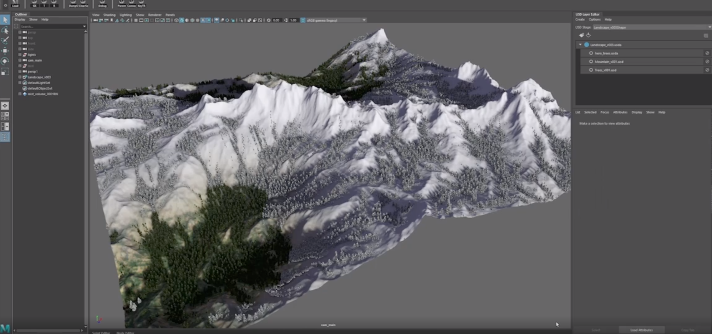
Autodesk Maya
A 3D animation and visual effects software, Autodesk Maya is a common tool used in the art world, but it can also be a helpful tool for civil engineers. Its powerful tools allow users to iterate more quickly, meaning that you can focus on creativity and on meeting your deadlines.
It has stunning visual tools that will keep clients coming back and can help you visualize anything from initial 3D plans to the finished product you’re expecting to create. It’s also able to scale for complexity, meaning you won’t be limited at all in what you can create.
via Autodesk
3D modeling is an essential part of civil engineering, from both the client’s and engineer’s perspectives. That’s because it gives both parties built-to-scale representations of a project rather than going through different 2D drawings and patterns to grasp the project’s overall design endpoint.
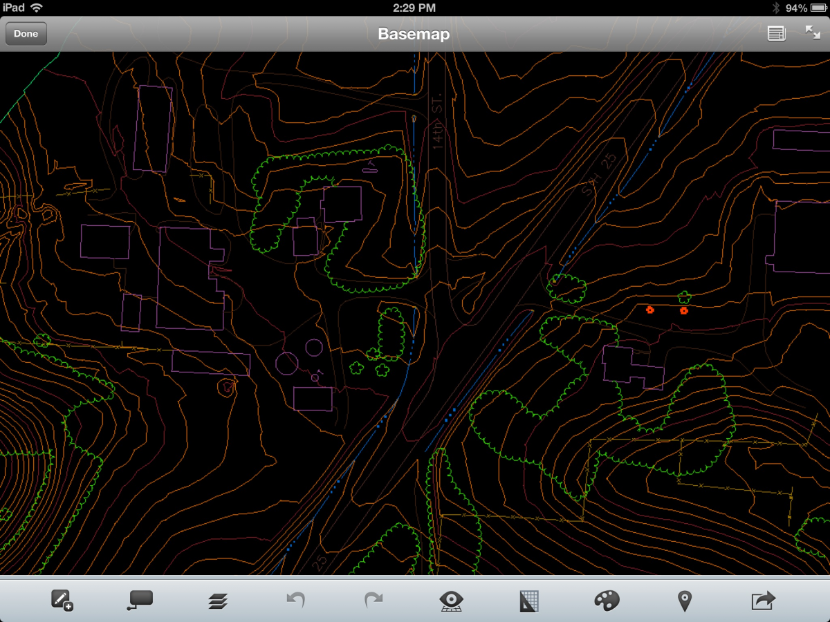
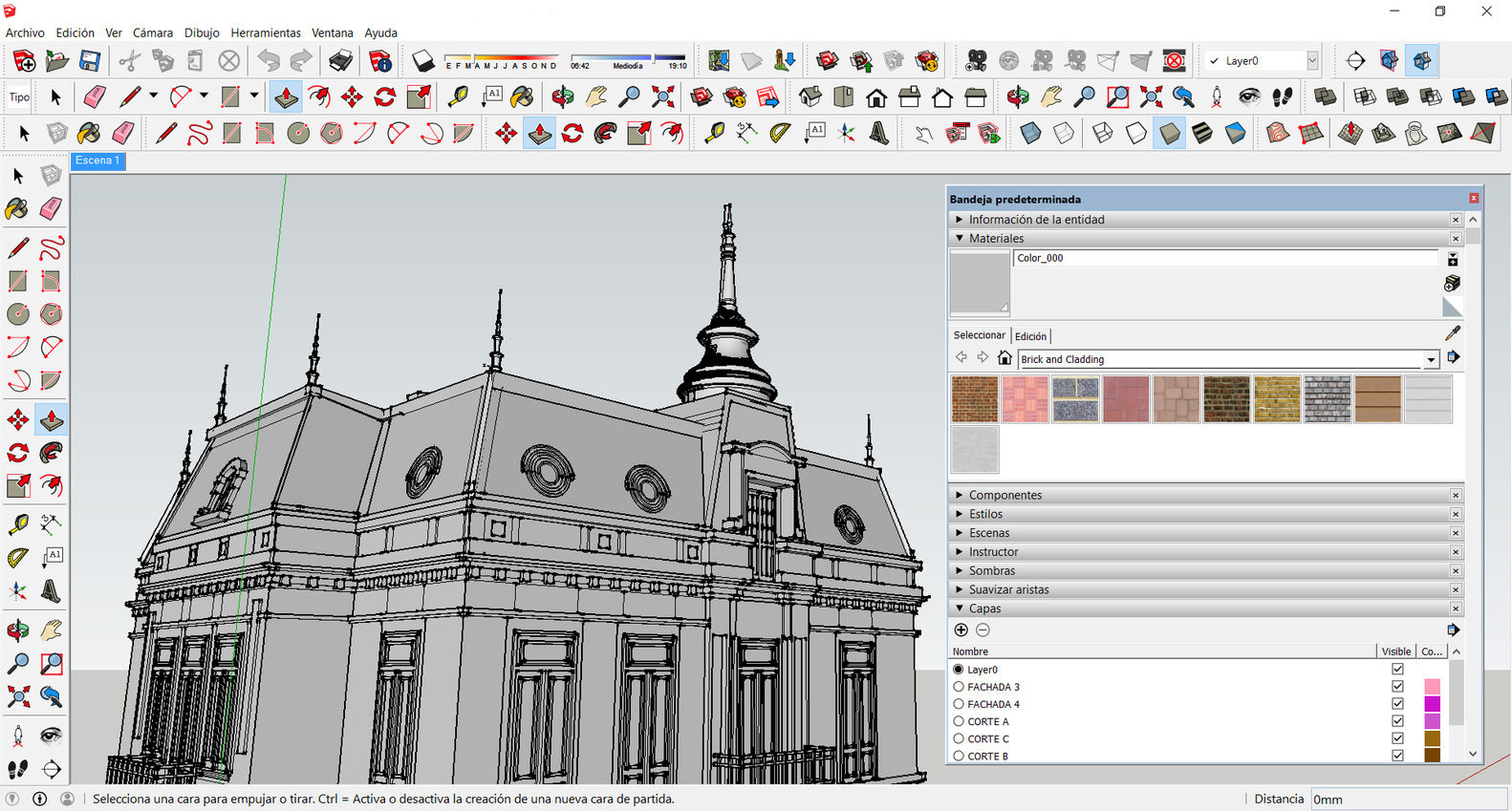
SketchUp
Formerly known as Google SketchUp, this product is a 3D modeling software with many different drawing applications. It can be used in not only the civil engineering industry, but also architecture, interior design, landscaping, film, and video game design.
While it has a “Pro” tier, the basic version of SketchUp is free, and it runs right on your web browser. You can use it wherever you have an internet connection. The application also offers 10 GB of cloud storage so that you can share projects and collaborate with your team.
via ArchDaily
As an added bonus, you’ll be able to view 3D models on your mobile device with the SketchUp Viewer, but you can also document in 2D even after drawing in 3D. It’s an interoperable program with the ability to both import and export SKP, JPG, and PNG files.
Its 3D warehouse gives users access to user-generated and manufacturer-generated models to incorporate into their designs if they so choose. For those of us attached to drawing by hand, SketchUp is an especially attractive application that also has iPad capabilities.
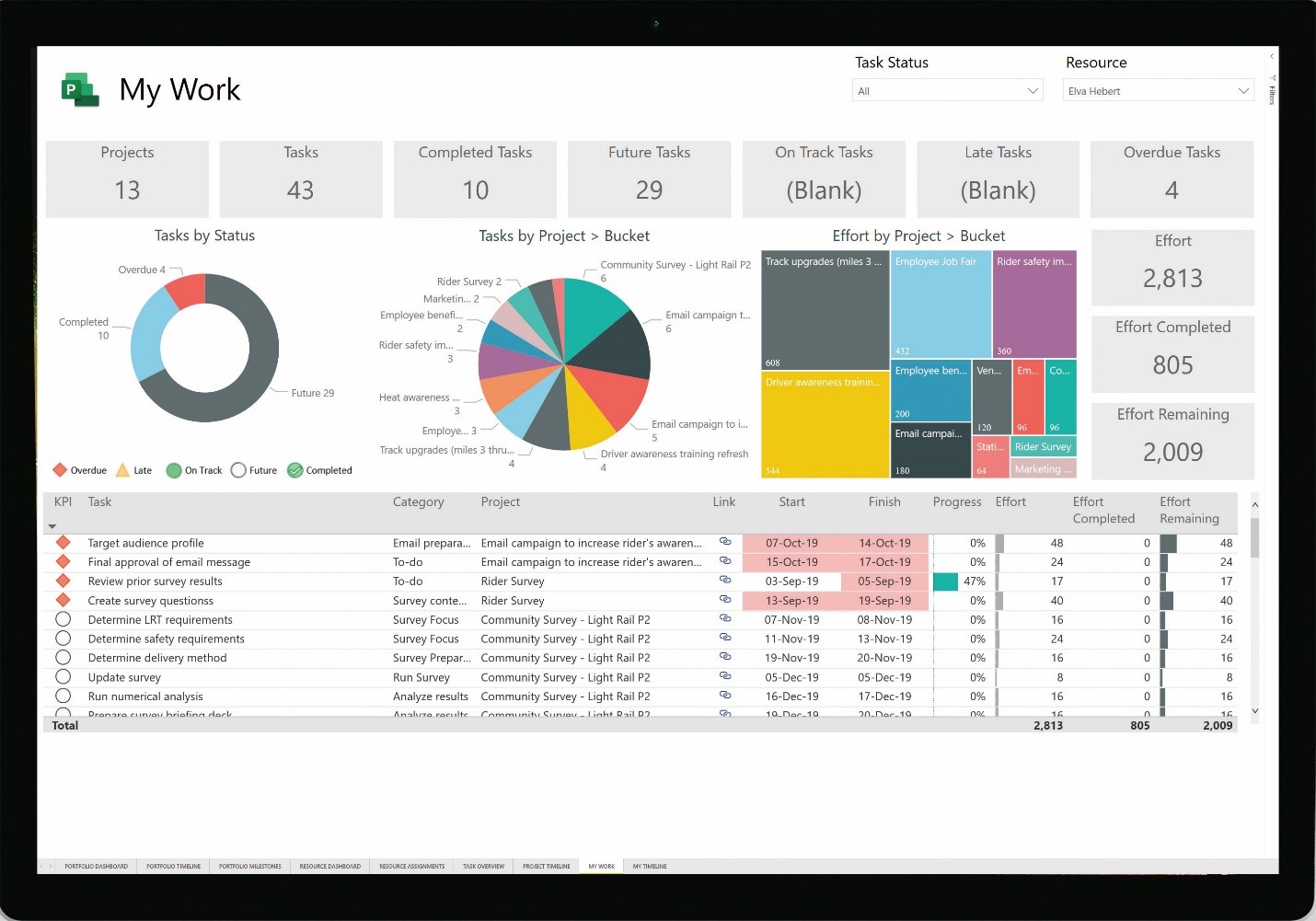
Microsoft Excel
Of all the programs on this list, Microsoft Excel is probably the most familiar. For those who haven’t used Excel before, it’s a spreadsheet program developed by Microsoft for use on Windows, macOS, Android, and iOS. Its features include calculation tools, graphing tools, pivot tables, and a macro programming language called Visual Basic for Applications.
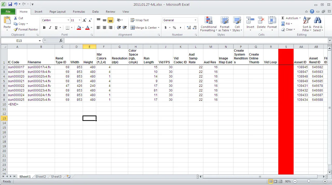
Excel is used as a part of nearly every stage in civil engineering projects: execution, surveying, planning, contracts, budgeting, designing, quality control, quantity estimation, and more. It’s also very easy to interpret or modify data as needed once it’s been added to an Excel spreadsheet.
Primavera P6
A project management software developed by Oracle and tailored specifically to the needs of the construction and engineering industries, Primavera P6 is a helpful project management solution for civil engineers. Users are able to manage projects of various sizes, from planning to execution.
via Oracle
For civil engineers, Primavera P6 has a number of benefits. It can increase planning efficiency, reduce the risk of schedule overruns, and identify bottlenecks so that users can take corrective action early. It also provides insight into current and future resource usage to aid in accurate forecasting and decision-making.
Primavera is often used for planning, scheduling, and controlling large-scale programs as well as individual projects. It allows multiple users to access schedules, enables project managers to coordinate costs, and can be used to open and schedule multiple projects simultaneously. Overall, it’s an attractive project management tool that’s optimized for the industry.
HEC-HMS
The Hydrologic Modeling System (HEC-HMS) is considered a standard when it comes to hydrologic simulation. It’s designed to simulate the hydrologic processes of watershed systems, providing you with all the drainage tools you could possibly need to estimate runoff.
When you use HEC-HMS, you describe the physical properties of a watershed and the meteorology that acts on the watershed during a defined span of time. The program then produces easy-to-understand simulation results. You’ll get summary tables for elements like peak flow, total volume, depth, and storage values in reservoirs and ponds, and others.
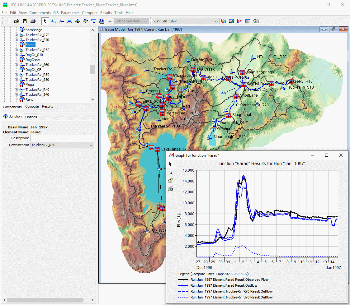
via U.S Army Corps of Engineers
Supplemental analysis tools are included for model optimization, forecasting streamflow, depth-area reduction, assessing model uncertainty, erosion and sediment transport, and water quality. The software also features a completely integrated work environment that includes a database, data entry utilities, a computation engine, and results reporting tools.
HEC-HMS has a graphical user interface that allows users to move seamlessly between different parts of the software. For that reason, it’s generally considered accessible. Simulation results are stored in the linked HEC-DSS (Data Storage System) so they can be used for studies on topics like water availability, urban drainage, and others.
The program was developed at the Hydrologic Engineering Center (hence the “HEC” components of the name) of the U.S. Army Corps of Engineers. It’s since been made available to the public.
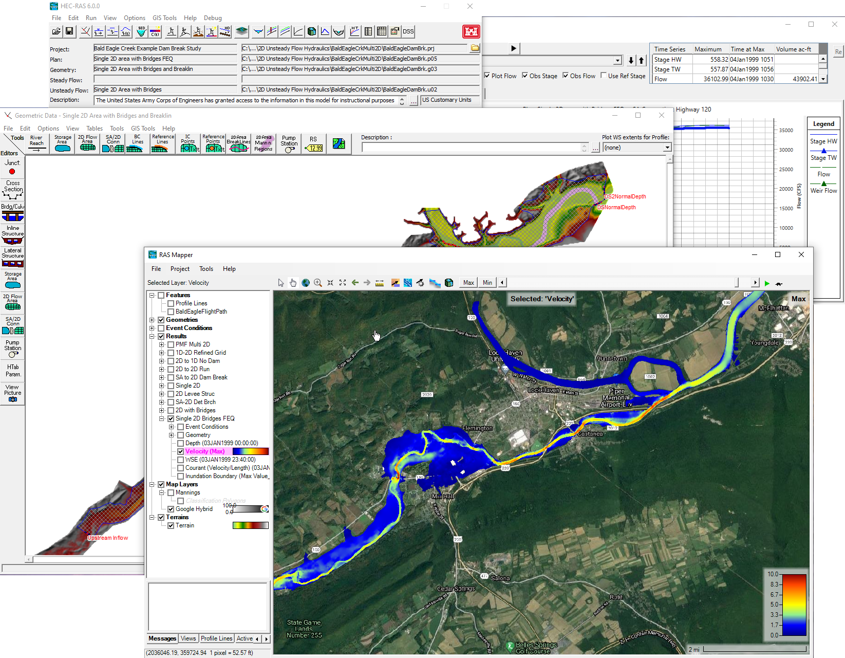
HEC-RAS
Like HEC-HMS, HEC-RAS (River Analysis System) is also a product of the Hydrologic Engineering Center of the U.S. Army Corps of Engineers. The program models the hydraulics of water flow through rivers and channels of many different cross-sections or over a terrain characterized by gridded cells.
via U.S Army Corps of Engineers
HEC-RAS can help civil engineers determine whether or not water can travel through specific structures (such as channels, bridges, streams, culverts, and others) without causing adverse flooding in the surrounding area. The system can analyze steady and unsteady flow alike, as well as sediment transport computations and water quality components.
A key element throughout its four analysis components is that all of them use a common geometric data representation and common geometric and hydraulic computation routines. In addition to these river analysis components, the system contains several hydraulic design features that can be used once the basic water surface profiles have been computed.
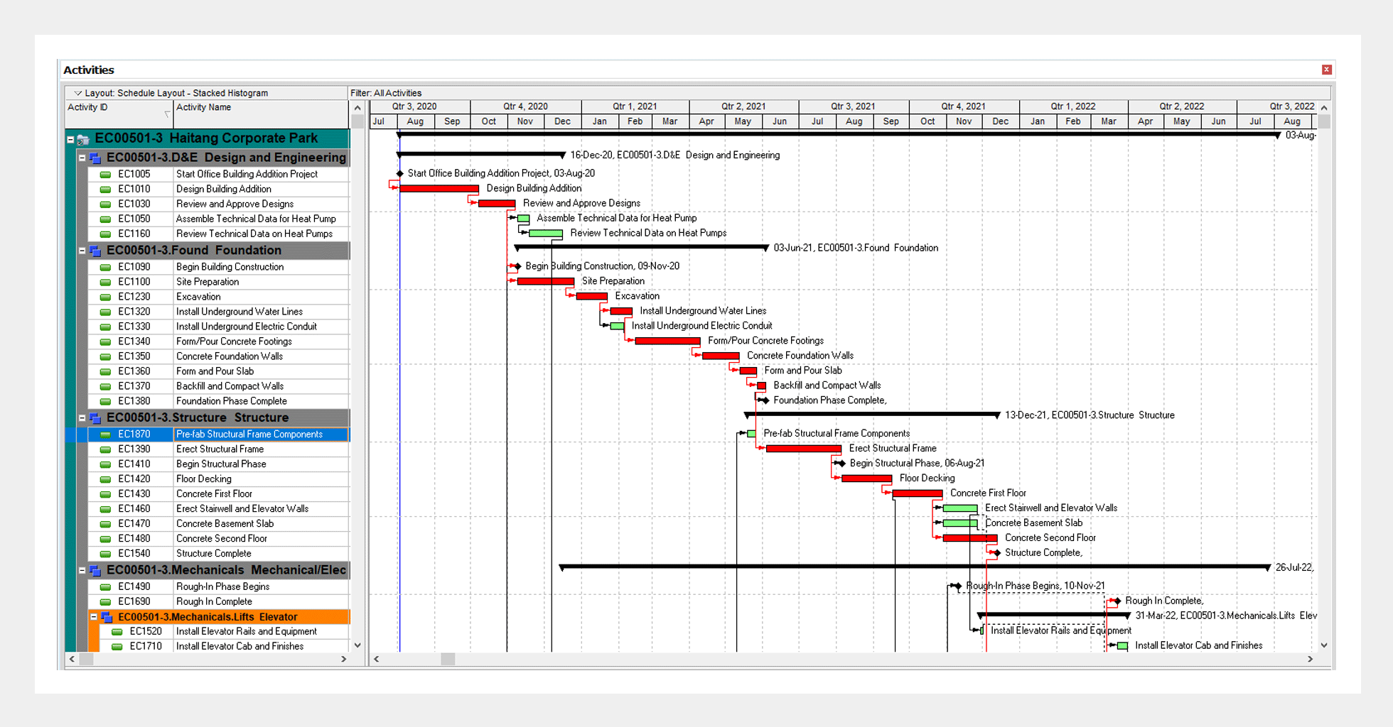
Microsoft Project
Unlike some of the other tools on this list, Microsoft Project is not exclusive to the civil engineering industry. Project is Microsoft’s native project management tool, and it’s helpful for scheduling across many industries.
Every civil engineer knows the importance of scheduling when it comes to managing construction and engineering projects. Microsoft Project has a deep understanding of basic scheduling concepts like activity relationships, critical paths, Gantt Charts, and more. It enables users to create detailed schedules so they can manage multiple different projects.

via Microsoft
Plus, the user interface is quite similar to that of Microsoft Office (especially Microsoft Excel). That means that for anyone familiar with the Microsoft suite of products, navigating the program comes naturally.
Microsoft Project is an excellent way for civil engineers to keep projects on track. The program offers dynamic scheduling based on the effort needed, project duration, and allotted team members. It also allows you to create automated workflows in order to ensure tasks get done without you being tied to your desktop.
StormCAD
Many civil engineers use StormCAD daily. It’s a modeling and analysis program for drainage systems, stormwater, and sanitary sewer designs. It’s made for sizing pipes and structures for various development projects. StormCAD is able to provide calculations for drainage area runoff, inlet capacity, gutters and pipe network flow, and more.
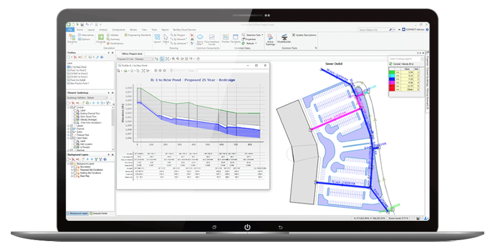
via Bentley Systems
The outputs and custom report generator are exceedingly helpful when it comes to providing the necessary information to ensure the system you’re building is engineered correctly. Plus, StormCAD has GIS and AutoCAD support, meaning that importing and exporting between programs is streamlined, making your job even easier.
SSA (AutoDesk Storm and Sanitary Analysis)
Autodesk Storm and Sanitary Analysis is an add-on for Autodesk’s AutoCAD Civil 3D program. It’s a comprehensive hydrology and hydraulic analysis application that’s optimized for planning and designing urban drainage systems, storm sewers, highway drainage systems, and sanitary sewers.
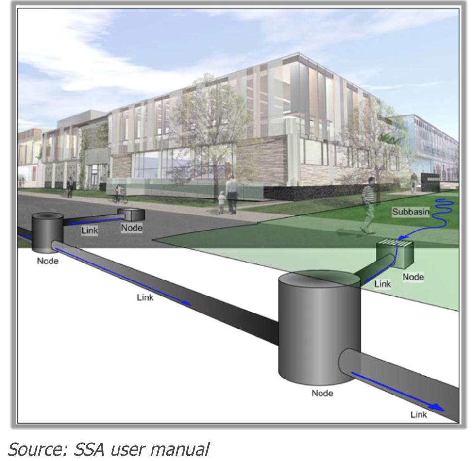
via InfraTech Civil
Similar to StormCAD, Autodesk SSA integrates stormwater and wastewater analysis during the planning and design phases. This helps you improve overall project productivity and increases your capabilities as a civil engineer.
Current versions of Autodesk AutoCAD Civil 3D come with SSA, and utilizing both software programs is easy as they have the ability to import and export back and forth as you update your design. Whether you’re designing or sizing pipes, planning detention facilities, or designing drainage channels, SSA is a user-friendly program that can make your job easier.
WaterCAD
Like StormCAD, WaterCAD is a Bentley program used for utility design. It’s specifically focused on water distribution networks and is a hydraulic model that can help you design improvements like the pipe size and location, pump size and location, and more. It does this by using network details like appurtenances and fire flow data.
WaterCAD is especially user-friendly and intuitive. It allows you to design new water systems as well as manage existing water networks effectively in order to reduce disruption risks and energy use. WaterCAD can be used within MicroStation or AutoCAD or it can be used as a standalone application for additional flexibility.
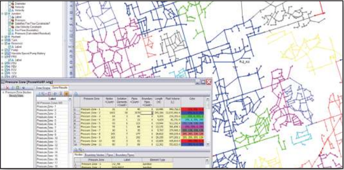
screenshot from Bentley Systems
There are many important uses of WaterCAD that civil engineers rely on daily. With what-if scenario management, you can easily analyze an existing water distribution system and predict how it will react in the future. WaterCAD also allows you to reduce energy expenses by comparing different pump strategies in order to select the most cost-effective option.
Its pipe and valve analysis system enables you to discover the weakest links in your water distribution systems as well as evaluate the adequacy of isolation valves. You’ll also be able to quickly and easily analyze water quality, including determining water age, discovering water sources, analyzing chlorine decay, and performing multispecies analysis.
EPANET
A free alternative to WaterCAD, EPANET was released by the United States Environmental Protection Agency (EPA). The software program models water distribution systems and can output the flow of water in each pipe, the pressure at each node, and more.
EPANET is used worldwide to model water distribution systems. While it was developed as a tool for understanding the movement of drinking water constituents within distribution systems, it has many different applications in the world of distribution systems analysis.
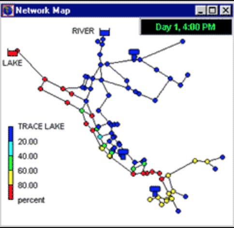
screenshot from U.S. EPA
Many civil engineers and consultants use EPANET today to design and size new water infrastructure, retrofit aging existing infrastructure, optimize operations of tanks and pumps, reduce energy usage, investigate water quality problems, and prepare for emergencies.
In terms of emergency preparation, EPANET can be used to model contamination threats and evaluate resilience to security threats or natural disasters related to water infrastructure.
As an added bonus, it’s a free software in the public domain that’s allowed to be copied and distributed. EPANET is a Windows-based program, so it works with all versions of Windows. On other computing systems, it may not be as useful.
ArcGIS
ArcGIS was released by ESRI, the Environmental Systems Research Institute. ESRI is a supplier of geographic information system (GIS) software. Its ArcGIS product is a mapping platform that’s incredibly useful to civil engineers and can be used to manage and understand various types of data as well as create many different exhibits.
It houses data resources such as images, shp files, and more—meaning you can layer many different types of information on top of each other. ArcGIS allows users to take utility, property, and other information and then layer those pieces of data on top of imagery, street maps, or topographic maps in order to capture the needs of a project in a neat and orderly way.
screenshot from ESRI
ArcGIS has a multitude of attractive features. It allows users to quickly create maps that overlay different information, and it includes smart mapping styles that make data look visually appealing. The program also includes intuitive analysis tools to help users better understand data. It’s home to demographic and lifestyle data that can add context to engineering plans.
You’ll be able to work with your data easily in the ArcGIS system, as it geoenables, hosts, and scales projects. Users can precisely collect, update, and control access to projects. Further, civil engineers often use ArcGIS to instantly share maps – the software is cloud-based, so it can be used anywhere and at any time.
Bluebeam Revu
Often referred to as simply “Bluebeam,” this software is a multi-tool PDF editor that allows civil engineers to create, edit, and mark up PDFs quickly and easily. While it might sound simple, Bluebeam is essential for easily combining documents, redlining plans or documents, and accurately measuring and marking up plans or documents no matter the scale.
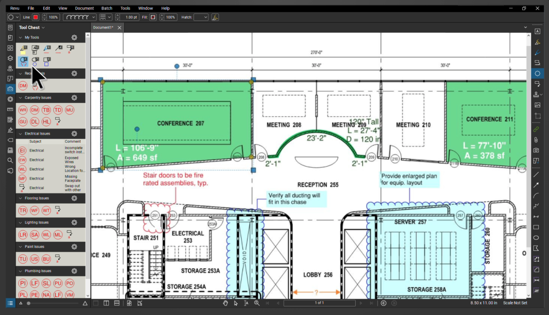
via Bluebeam
Unlike other PDF editing software, Bluebeam is optimized specifically for the construction and civil engineering industries. That means it has features that are tailored specifically to your needs and for the demands of the civil engineering industry, setting it apart from competitors like the Adobe suite of products.
MicroStation V8i
Another Bentley product, MicroStation is often considered the foundation of infrastructure design projects, and it’s a software program that’s often used by Fenstermaker. It’s a huge part of the design and engineering solutions for civil engineers.
MicroStation provides its users with power, flexibility, and best-in-class tools. Best of all, there’s no need for add-ons. MicroStation can help you minimize risk, accelerate automation, and win more contracts.
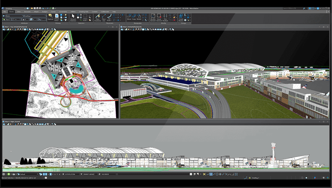
via Bentley Systems
In terms of its design offerings, MicroStation allows users to create geospatially enabled 2D and 3D drawings for infrastructure projects, delivering them on time and on budget regardless of project complexity and scale. It also produces better documents to communicate design intent and those documents are industry compliant.
With easy-to-use collaboration tools so that your whole team can be easily kept in the loop, MicroStation V8i is a favorite of many civil engineers.
HydroCAD
HydroCAD is a simple, intuitive software with an attractive cost-to-benefit ratio. It’s user-friendly and it has high-quality customer support. Although it may look more rudimentary or lower-tech than some other programs on the list, it gets the job done without any unnecessary frills.
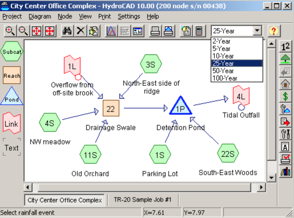
via HydroCAD
The program is a computer-aided design tool made for civil engineers to model stormwater runoff. It provides a range of commonly used hydrology and hydraulics capabilities, including runoff hydrology (SCS, NRCS, and SBUH), rational method with automatic IDF curves, usage of local rainfall data in the built-in rainfall library, and many more.
It also offers easy management and reporting of multiple rainfall events, and its many in-house automatic calculations make it simple and efficient for civil engineers to get the data they need. The software can run on any Windows PC and it doesn’t require any other CAD software to use.
InRoads V8i (SS2)
InRoads is an add-on to the MicroStation V8i product from Bentley. It’s an extremely versatile civil design application that’s relevant for many different types and sizes of civil engineering projects worldwide. It’s made to address a wide variety of complex tasks like interchange design, roundabout design, earthworks, surveying, subsurface utilities, and more.
InRoads eliminates the frustrations associated with traditional 2D methods and makes it easier to communicate with your whole team about the final visualization of a project. The program is tailored especially for road design, and it’s a one-stop shop for geometrics, survey, drainage, utilities, quantity takeoff, cut/fill, site grading, lane configurations, and mobility.
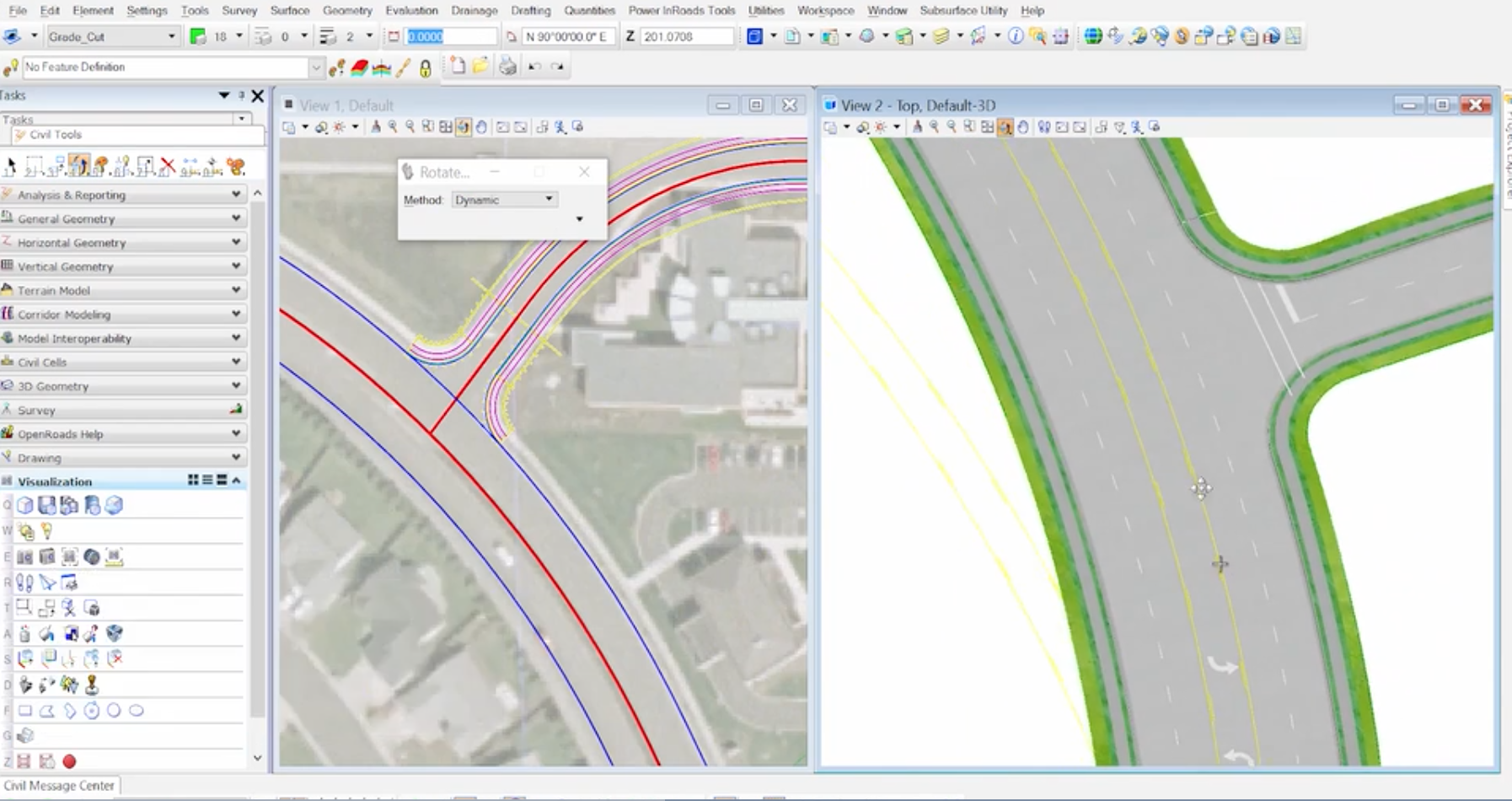
via Bentley Systems
Roadway designers and civil engineers need software that can collaborate seamlessly across disciplines and address growing industry demands. InRoads meets those requirements and also includes plenty of automation to remove tedious manual work.
LumenRT Connect
A real-time visualization and reality modeling software by Bentley Systems, LumenRT allows users to integrate life-like digital nature into simulated infrastructure designs. This enables civil engineers to create high-impact visuals in seconds.
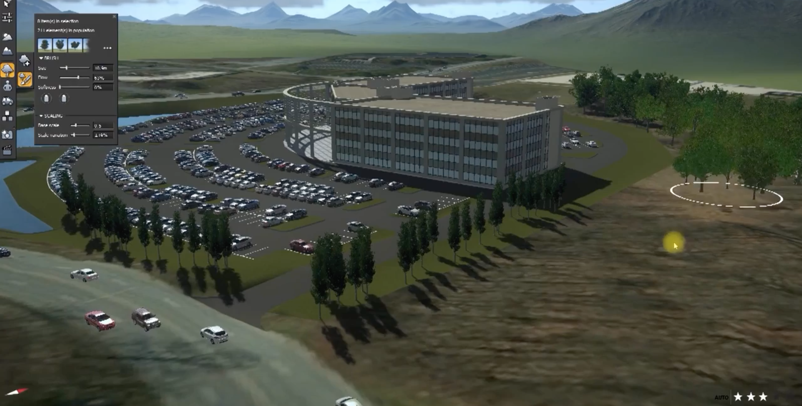
via Bentley Systems
When you’re using LumenRT, you can populate models with animated people and animals, moving vehicles, and many other elements. It’s a tool that can help your presentations of projects become much more compelling and interesting for clients and engineers alike.
LumenRT easily integrates with MicroStation, Autodesk Revit, ESRI CityEngine, Graphisoft ArchiCAD, and Trimble SketchUp. Its connections to these other applications make it a versatile and attractive add-on to any civil engineering software suite.
Global Mapper
A cutting-edge GIS software, Global Mapper provides novice and experienced geospatial professionals alike with a comprehensive suite of spatial data processing tools. It also allows access to an unmatched variety of data formats.
Global Mapper boasts an intuitive user interface and a logical layout that reduces the length of the learning curve needed to use the program. Users will be comfortable with the program in no time due to its easy-to-learn features.
Any civil engineer or civil engineering organization that uses Global Mapper is sure to see a significant return on investment. That’s because Global Mapper offers efficient data processing paired with accurate map creation and optimized spatial data management.
For any civil engineer who uses mapping frequently—with applications like earthwork construction planning, road site planning, corridor analysis, and modeling dam
construction—Global Mapper is a must-have.
Final Thoughts
Civil engineering is a diverse field with jobs in design, research, and construction. No matter what portion of the industry you’re working in, however, you’ll often find that the software programs on this list are heavily used. That’s true whether you’re working on buildings, transportation systems, environmental impact projects, or water conservation.
No matter what your specialty is, you’re sure to find many of the above software programs. If you’re looking to get into the field of civil engineering, it can be helpful to familiarize yourself with some of these programs in order to get a leg up over other job applicants and help yourself succeed in the workplace.
If you’re already a civil engineer, these software programs can take your work to the next level.


